
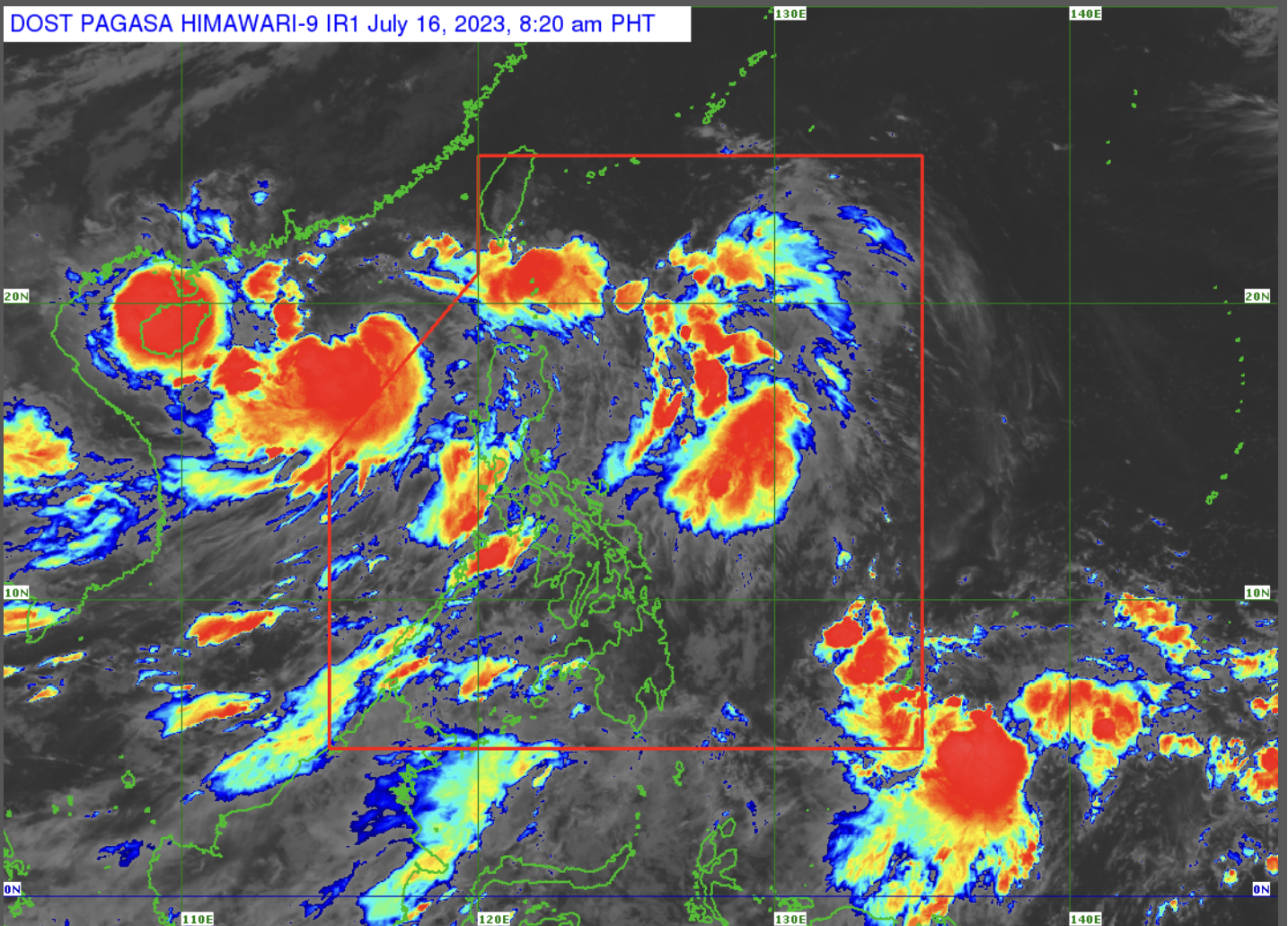
Pagasa monitors tropical storm ‘Dodong’ at 90 kilometers west of Laoag City, Ilocos Norte, moving 20 kilometers per hour outside Philippine area of Responsibility. (Photo courtesy of Pagasa)
MANILA, Philippines — Tropical storm Dodong (international name Talim) continues to move west-northwest away from the Philippine area of Responsibility (PAR), but its enhancement of southwest monsoon or “habagat” will bring rain in most parts of the country, the state weather bureau said on Sunday.

Citing its 5 a.m. bulletin Philippine Atmospheric, Geophysical and Astronomical Services Administration (Pagasa) said Dodong was last monitored 390 kilometers (km) west of Laoag City, Ilocos Norte, moving 20 kilometers per hour (kph) and carrying maximum sustained winds of 85 kph and gusts of up to 105 kph.
“Wala na itong (Dodong) epekto sa anumang bahagi ng ating kapuluan ngunit itong southwest monsoon ay nagdudulot pa rin ng mga pagulan sa malaking bahagi ng ating bansa,” weather specialist Daniel James Villamil said in a morning forecast.
(Dodong no longer affects any part of our landmass, but the southwest monsoon still brings rains to a large part of our country.)
“Umiiral ito sa buong Pilipinas at magdadala ito ng mga pag-ulan sa buong Luzon kasama na dyan ang Metro Manila at sa Western Visayas,” he added.
(It affects the Philippines and will bring rains all over Luzon, including Metro Manila, as well as in Western Visayas.)
Due to habagat, Villamil reported that the state weather bureau raised a gale warning in the following seaboards:
- Batanes
- Babuyan Islands
- Romblon
- Marinduque
- Ilocos Norte
- Ilocos Sur
- La Union
- Pangasinan
- Zambales
- Bataan
- Western coast of Batangas
- Occidental Mindoro, including Lubang Island
- Palawan, including Calamian, Cagayancillo, Cuyo, and Kalayaan Islands
- southern coast of Quezon
- Antique
- Iloilo
- Guimaras
- Northwestern coast of Aklan
Pagasa likewise spotted cloud clusters east of Mindanao outside PAR, which Villamil said may become a low-pressure area.
Meanwhile, below is the forecast temperature range in key cities or areas for Sunday:
- Metro Manila: 24 to 30 degrees Celsius
- Baguio City: 17 to 23 degrees Celsius
- Laoag City: 26 to 32 degrees Celsius
- Tuguegarao: 24 to 32 degrees Celsius
- Legazpi City: 24 to 30 degrees Celsius
- Puerto Princesa City: 26 to 30 degrees Celsius
- Tagaytay: 22 to 33 degrees Celsius
- Kalayaan Islands: 25 to 30 degrees Celsius
- Iloilo City: 25 to 32 degrees Celsius
- Cebu: 26 to 30 degrees Celsius
- Tacloban City: 26 to 31 degrees Celsius
- Cagayan De Oro City: 25 to 31 degrees Celsius
- Zamboanga City: 25 to 31 degrees Celsius
- Davao City: 25 to 33 degrees Celsius