
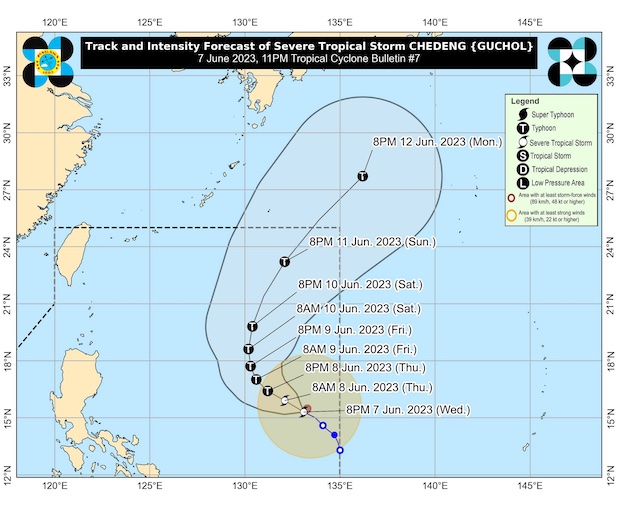
The track of Severe Tropical Storm Chedeng (international name: Guchol) in a map posted by Pagasa in its 11 p.m. bulletin on Wednesday, June 7, 2023.
MANILA, Philippines — Chedeng (International name: Guchol) has intensified into a severe tropical storm late Wednesday night but is still not directly affecting the country, the state weather bureau said in its 11 p.m. bulletin.
The eye of the storm was last sighted 1,220 kilometers east of Southeastern Luzon, according to the Philippine Atmospheric, Geophysical and Astronomical Services Administration (Pagasa).
Its maximum sustained winds increased from 85 to 95 kilometers per hour and its gustiness is now up to 115 kph.
It is heading west-northwest at 10 kph.
“Owing to favorable environmental conditions, Chedeng is forecast to intensify in the next three days and may be upgraded into a typhoon by tomorrow,” Pagasa said.
But, it noted, Chedeng was “unlikely to directly bring heavy rainfall over any portion of the country in the next three to five days,” but it could still reach peak intensity by Friday or Saturday.
Based on the forecast track, Chedeng will remain far from the Philippine landmass. It is also expected to slow down while heading northward on Friday, and then it will begin accelerating northeast on Sunday.
It is forecast to leave the Philippine area of responsibility by late Sunday or early Monday.