
PAGASA SATELLITE
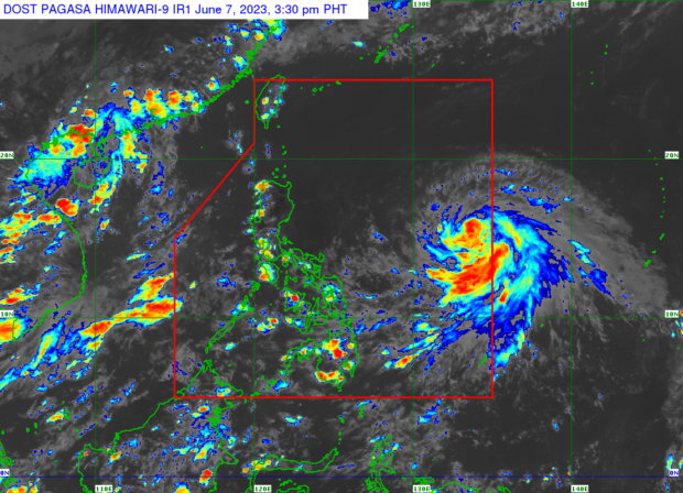
MANILA, Philippines — Tropical storm Chedeng (International name: Guchol) has picked up strength while heading west-northwestward over the Philippine Sea on Wednesday afternoon, said the state weather bureau.

Chedeng’s maximum sustained winds rose from 75 to 85 kilometers per hour and gustiness of up to 105 kph, according to the Philippine Atmospheric, Geophysical and Astronomical Services Administration (Pagasa).
Pagasa said Chedeng’s eye was last monitored 1,150 kilometers east of Southeastern Luzon.
“Tropical storm Chedeng is unlikely to directly bring heavy rainfall over any portion of the country in the next three to five days,” the weather service said.
It also noted that while Chedeng may enhance the southwest monsoon prevailing over the country, the timing and intensity of monsoon rains may still change depending on the forecast movement and strength of Chedeng and its interaction with other weather systems.
Chedeng, according to Pagasa, will remain far from the country’s landmass throughout the forecast period.
“Owing to favorable environmental conditions, Chedeng is forecast to intensify in the next three to four days and may be upgraded to severe tropical storm category tonight or tomorrow and into a typhoon on late Thursday or Friday,” it said.
Chedeng may still rapidly intensify and reach peak intensity by Friday or Saturday, Pagasa added.
LIVE UPDATES: Tropical storm ‘Chedeng’