
(Updated: 6 p.m., June 1, 2023)
MANILA, Philippines — Severe Tropical Storm Betty is now out of the Philippine area of responsibility (PAR) on Thursday afternoon, state meteorologists said.
“Betty exited PAR at around 4 p.m.,” Philippine Atmospheric, Geophysical and Astronomical Services Administration (Pagasa) weather specialist Veronica Torres told INQUIRER.net over the phone.
Despite Betty’s departure, Pagasa said rain shower is still possible due to southwest monsoon, locally known as habagat, according to Pagasa’s final bulletin for this severe tropical storm.
“As Betty continues to move away from the country, the Southwest Monsoon will become the dominant rain-causing system in the country within the day,” Pagasa said in its 5 p.m. report.
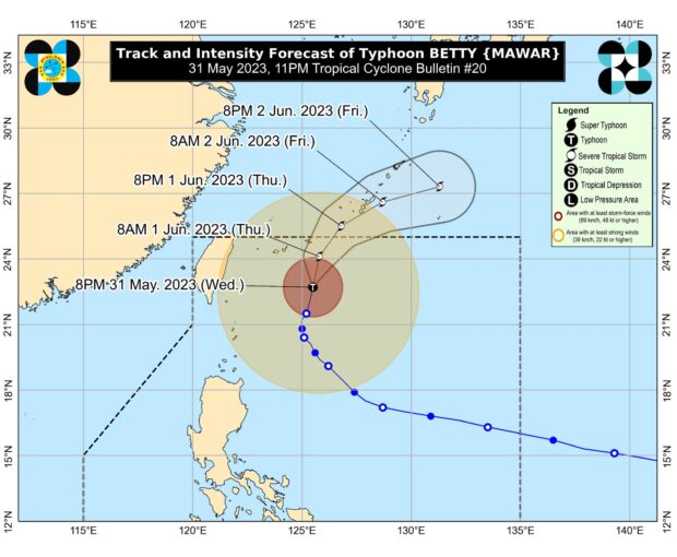
As of 4 p.m., the center of Betty’s eye was last spotted 685 kilometers northeast of Itbayat, Batanes, packing maximum sustained winds of 95 kilometers per hour (kph) near the center with gustiness of up to 115 kph.
The typhoon is moving north northeastward at 15 kph before making landfall in the territory of Japan.
“Outside the PAR, the severe tropical storm may make landfall or pass very close to Okinawa Island tonight or tomorrow early morning,” Pagasa said.
Meanwhile, Betty could be downgraded to tropical storm category on Saturday.
READ: Pagasa: Betty weakens into severe tropical storm; to exit PAR Thursday