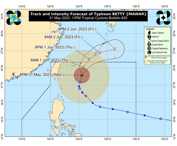
Pagasa may lift all remaining signals due to Betty by Thursday
MANILA, Philippines — State meteorologists said all remaining Tropical Cyclone Wind Signals (TCWS) hoisted over parts of Luzon will be lifted by Thursday as Typhoon Betty (international name: Mawar) was already heading out of the Philippine area of responsibility (PAR).
“Wind Signals in Babuyan Islands have been lifted. Should there be no significant changes in the track or extent of tropical cyclone winds of Betty, all remaining wind signals may be lifted by tomorrow,” the Philippine Atmospheric, Geophysical and Astronomical Services Administration (Pagasa) said in its 11 p.m. report on Wednesday.
To date, Pagasa only hoisted Signal No. 1 over Batanes.
As of 4:00 a.m., the center of Betty’s eye was last spotted 450 kilometers northeast of Itbayat, Batanes, with maximum sustained winds of 120 kilometers per hour (kph) near the center and gustiness of up to 150 kph.
The typhoon was moving northward at 10 kph.
On the track forecast, the tropical cyclone will be outside PAR by Thursday evening or Friday early morning.
