Super Typhoon Mawar may whip up monsoon rain in Luzon, Visayas next week

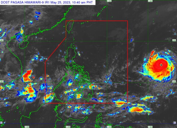
Weather satellite image from Pagasa’s website
MANILA, Philippines — Super Typhoon Mawar, heading toward the Philippine area of responsibility (PAR), may bring about monsoon rain over parts of Luzon and Visayas next week, state meteorologists said Thursday.
“Mawar is forecast to enhance the Southwest Monsoon and may trigger monsoon rains over the western portions of Luzon and Visayas beginning on Sunday or Monday,” the Philippine Atmospheric, Geophysical and Astronomical Services Administration (Pagasa) said in its 11 a.m. weather bulletin.
“However, the monsoon rains scenario may still change due to the dependence of Southwest Monsoon enhancement on the track and intensity of Mawar,” it added.
READ: Mawar strengthens into super typhoon again, says Pagasa
The state weather bureau said that as of 10:00 a.m., the center of the super typhoon’s eye is located 2,065 kilometers east of southeastern Luzon and that Mawar was packing maximum sustained winds of 185 kilometers per hour (kph) and gustiness of up to 230 kph.
Article continues after this advertisementMawar is forecast to continue intensifying in the next three days and may reach a peak intensity of 215 kph by Sunday, May 28, before weakening – “although it will remain a typhoon by the end of the forecast period,” according to Pagasa.
Article continues after this advertisementREAD: LIST: Class suspensions on Friday, May 26, due to Mawar
Mawar is expected to enter the PAR on Friday evening or Saturday morning.
Once it enters the PAR, Mawar will be given the local name “Betty,” the second storm to hit the country this year and the first this month.
READ: Guam weathers Category 4 super typhoon without major damage
Betty was also used for a typhoon that hit the Philippines in 2015 and 2019. But Pagasa may reuse one of four sets of typhoon names on a four-year rotation.
RELATED STORIES
Guam braces for direct hit from Typhoon Mawar
Pagasa downgrades ‘Mawar’ into typhoon category