Pagasa: Expect rain in western parts of PH; typhoon still outside PAR
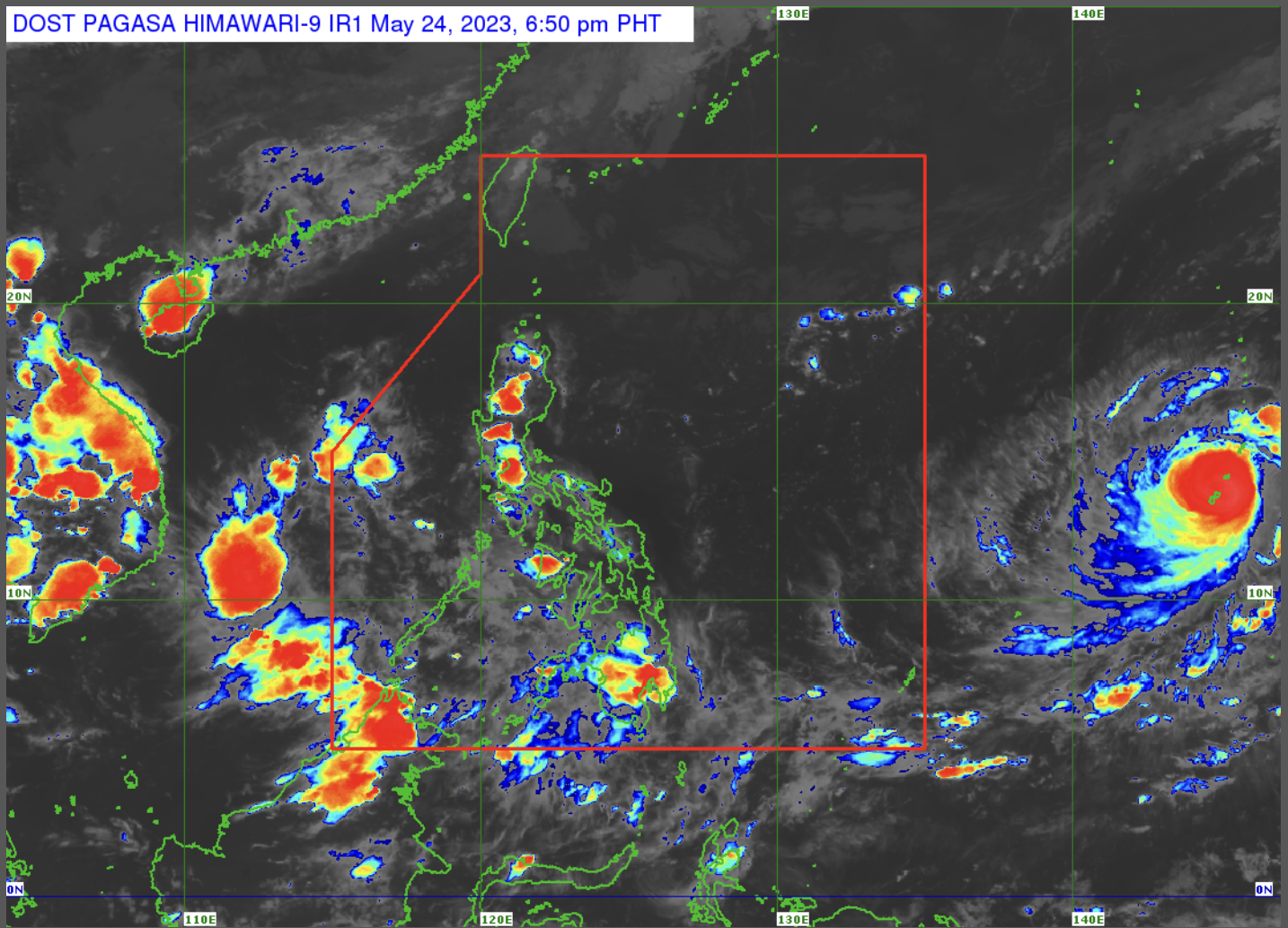
MANILA, Philippines — Rain showers are expected to prevail in the western parts of the country due to the southwesterly wind flow, while Typhoon ‘Mawar’ remains outside the Philippine area of responsibility (PAR), the state weather bureau said on Wednesday afternoon.
According to the Philippine Atmospheric, Geophysical and Astronomical Services Administration (Pagasa), the southwesterly wind flow will specifically affect the western parts of Southern Luzon, Visayas, and Mindanao, while the rest of the country may experience isolated rain showers and localized thunderstorms.
“Sa Metro Manila at sa nalalabing bahagi ng ating kapuluan ngayong hapon hanggang mamayang gabi may mga tsansa pa rin ng mga pulo pulong mga pagulan, pagkidlat, at pagkulog,” Pagasa weather specialist Ana Clauren-Jorda said.
(Rain showers and localized thunderstorms may prevail in Metro Manila and the rest of the country this afternoon until tonight.)
Jorda said “Mawar” remains outside PAR and was last spotted some 2,170 kilometers east of the Visayas with maximum sustained winds of 175 kilometers per hour (kph) near the center and gustiness of up to 215 kph.
Article continues after this advertisementIt may intensify into a super typhoon by the next 36 hours.
Article continues after this advertisementJorda said Mawar will likely enter PAR by Friday or Saturday morning will be given the local name “Betty.”
The typhoon is currently moving northwest and has a slim chance of making landfall, Jorda said.
She added that Mawar would likely intensify the southwest monsoon or “habagat,” which may trigger rain in the western parts of Southern Luzon, Visayas, and Mindanao over the weekend.
No gale warning is in effect over any of the country’s seaboards.
Forecast temperature range in key cities / areas on Thursday
- Metro Manila: 26 to 32 degrees Celsius
- Baguio City: 18 to 22 degrees Celsius
- Laoag City: 26 to 34 degrees Celsius
- Tuguegarao: 26 to 36 degrees Celsius
- Legazpi City: 26 to 34 degrees Celsius
- Puerto Princesa City: 25 to 32 degrees Celsius
- Tagaytay: 23 to 31 degrees Celsius
- Kalayaan Islands: 26 to 32 degrees Celsius
- Iloilo City: 25 to 32 degrees Celsius
- Cebu: 25 to 33 degrees Celsius
- Tacloban City: 25 to 32 degrees Celsius
- Cagayan De Oro City: 25 to 32 degrees Celsius
- Zamboanga City: 22 to 33 degrees Celsius
- Davao City: 26 to 32 degrees Celsius