Pagasa spots new LPA that may turn into weak storm in 2-4 days

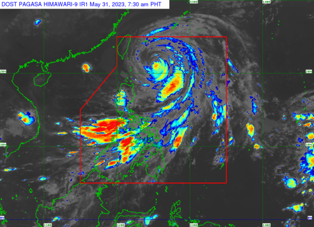
Weather satellite image from Pagasa’s website
MANILA, Philippines — The state weather service located a new low pressure area (LPA) outside the Philippine area of responsibility (PAR) on Wednesday which may become a tropical depression or a weak storm in the next two to four days.
The Philippine Atmospheric, Geophysical and Astronomical Services Administration (Pagasa) said the LPA was marked 2,200 kilometers east of Mindanao and that it may enter the PAR by the middle or end of next week.
It also said that conditions are “favorable” for it to become a storm possibly this coming weekend while still outside PAR.
Weather specialist Benison Estareja explained that the anticipated weather disturbance is not expected to affect any part of the country as it will remain far from the country’s landmass.
“Maaaring over the weekend hanggang sa Lunes ay maging isang tropical depression or mahinang bagyo po ito,” Estareja disclosed in a report Thursday.
Article continues after this advertisement(It may become a tropical depression or a weak storm over the weekend until Monday.)
Article continues after this advertisement“Inaasahang pahilaga, hilagang-kanluran ang direksyon nitong LPA sa susunod pong apat na araw at mananatiling malayo sa ating kalupaan. Hindi rin directly affecting any part of the country,” he added.
(The direction of this LPA is expected to be north, north-west for the next four days and will remain far from our land. It is not seen to directly affect any part of the country either.)
Pagasa said it will continue to monitor the new LPA. Estareja noted that its tendencies may still change.
“Dahil sa tagal pa, posibleng magbago ‘yung direksyon at characteristic nitong weather disturbance na ito,” concluded the specialist.
(Due to the duration, it is possible that the direction and characteristics of this weather disturbance will change.)
As for forecast temperature range in key cities/areas across the country for Thursday, May 18, Pagasa issued the following:
Luzon
- Metro Manila: 26 to 33 degrees Celsius
- Baguio City: 17 to 24 degrees Celsius
- Laoag City: 26 to 33 degrees Celsius
- Tuguegarao: 26 to 37 degrees Celsius
- Legazpi City: 26 to 34 degrees Celsius
- Puerto Princesa City: 26 to 32 degrees Celsius
- Tagaytay: 24 to 31 degrees Celsius
- Kalayaan Islands: 27 to 31 degrees Celsius
Visayas
- Iloilo City: 27 to 33 degrees Celsius
- Cebu: 27 to 34 degrees Celsius
- Tacloban City: 26 to 32 degrees Celsius
Mindanao
- Cagayan De Oro City: 26 to 33 degrees Celsius
- Zamboanga City: 25 to 34 degrees Celsius
- Davao City: 24 to 33 degrees Celsius
RELATED STORIES
‘Dangerous’ 46°C heat index alert: PH to brace for scorching Wednesday weather
Pagasa; Cloudy Wednesday with rain in Metro Manila, parts of Luzon
It’s official: Dry season begins as amihan bows out
Pagasa: Severe dry spell to start in next 3 months