Pagasa: Heavy rain likely in Palawan, new LPA spotted east of Mindanao
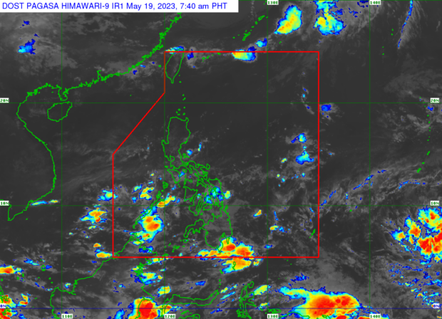
Weather satellite image from Pagasa’s website
MANILA, Philippines — The state weather bureau said that Palawan could experience moderate to heavy rain on Friday due to the low pressure area (LPA) it had been monitoring for the last three days.
The Philippine Atmospheric, Geophysical and Astronomical Services Administration (Pagasa) also reported that a new LPA has formed east of Mindanao, but this weather disturbance is still outside the Philippine area of responsibility and has no direct effect on the country yet.
“Patuloy na lumalapit ‘yung LPA sa loob ng Philippine area of responsibility, dito po sa lalawigan ng Palawan. As of 3 a.m., nasa 95 km ‘yung sentro ng LPA sa silangan ng Puerto Princesa City,” said weather specialist Benison Estareja, referring to the first LPA now affecting the country.
(The LPA continues to approach within the PAR, here in the province of Palawan. As of 3 a.m., the LPA’s center was located 95km east of Puerto Princesa City.)
Pagasa said this LPA will continue to move westward over the next three days and should reach the West Philippine Sea (WPS) by midnight of Saturday.
Article continues after this advertisement“Base po sa ating analysis, generally kikilos pa rin ito westward sa susunod po na tatlong araw. Ibig sabihin, ngayong araw ay dadaan po ito ng mainland Palawan, maaaring mamayang hatinggabi ay nasa may WPS na po ‘yung LPA,” Estareja said.
Article continues after this advertisement(Based on our analysis, the LPA will generally continue westward in the next three days. This means that it will pass by mainland Palawan today, and it is possible that it will reach the WPS later by midnight.)
“Pagsapit po sa WPS over the weekend, meron na rin pong katamtaman po na tsansa na maging isang mahinang bagyo o tropical depression. Papangalanan po natin ito na ‘Betty’ kung saka-sakali, at magpapaulan pa rin over the weekend sa malaking bahagi ng Palawan ang nasabing LPA,” he added.
(When it reaches the WPS over the weekend, there is a moderate chance that this LPA will become a weak typhoon or tropical depression. We will name it “Betty” if ever, and the LPA will continue to bring rain over a large part of Palawan over the weekend.)
READ: Pagasa: Approaching LPA likely to become ‘weak typhoon’
Meanwhile, the new LPA spotted 1,365km east of Mindanao is predicted to have a low chance of developing into a typhoon, according to Estareja.
Estareja also explained that the two LPAs are within the intertropical convergence zone (ITCZ), which Pagasa anticipates to bring continued rain to various parts of the country on Friday – specifically, in the Bicol Region and remaining parts of Mimaropa (Mindoro, Marinduque, Romblon, and Palawan) in Luzon, and Zamboanga Peninsula, Basilan, Sulu, and Tawi-Tawi in Mindanao.
Northern and central Luzon may still expect hot and humid weather due to the effects of easterlies, Pagasa also said, adding that scalding heat indexes may likely range from 38-40 degrees Celsius in Isabela, Cagayan, Ilocos Region, Nueva Ecija, Tarlac, and Metro Manila this Friday.
Skies will be mostly cloudy over Visayas, with high chances of occasionally heavy rain in Western Visayas, Negros Oriental, and Cebu, the state weather service further reported.
It also said that occasionally cloudy skies and rain may prevail in Zamboanga Peninsula, Basilan, Sulu, and Tawi-Tawi on Friday morning and possibly even throughout the day due to the ITCZ.
Pagasa’s forecast likewise showed high chances of rain in Dinagat Islands and Surigao provinces on Friday morning, while most of Mindanao may expect overcast skies especially in its mainland and central portions, Northern Mindanao, Soccsksargen (South Cotabato, Cotabato, Sultan Kudarat, Sarangani and General Santos), and mainland Bangsamoro.
Below are the predicted temperature range in key cities/areas across the country for Friday, May 5:
Luzon
- Metro Manila: 26 to 34 degrees Celsius
- Baguio City: 17 to 26 degrees Celsius
- Laoag City: 25 to 31 degrees Celsius
- Tuguegarao: 25 to 36 degrees Celsius
- Legazpi City: 25 to 31 degrees Celsius
- Puerto Princesa City: 25 to 27 degrees Celsius
- Tagaytay: 23 to 32 degrees Celsius
- Kalayaan Islands: 26 to 28 degrees Celsius
Visayas
- Iloilo City: 25 to 31 degrees Celsius
- Cebu: 26 to 31 degrees Celsius
- Tacloban City: 25 to 31 degrees Celsius
Mindanao
- Cagayan De Oro City: 25 to 31 degrees Celsius
- Zamboanga City: 26 to 35 degrees Celsius
- Davao City: 25 to 33 degrees Celsius
Pagasa did not raise any gale warnings over any of the country’s seaboards.
RELATED STORIES
Pagasa says LPA, ITCZ to bring rain in Eastern Visayas, Mindanao
El Niño may bring more rain to western part of PH during habagat season – Pagasa