
DEVELOPMENT AND THE ENVIRONMENT | A reclamation barge spews sand at the coast of Manila Bay along J.W. Diokno Boulevard in Pasay City on Sunday, Feb. 19, 2023. Environmental activists and fisherfolk groups continue their uphill battle in the campaign against development projects being planned at the historic bay and other areas in the country. (Photo by GRIG C. MONTEGRANDE / Philippine Daily Inquirer)
MANILA, Philippines — An expert in geology and environmental science has warned those planning to purchase reclaimed land, including on any of the multibillion-peso reclamation projects in Manila Bay, to be wary of the dangers that might come with their investment, such as land subsidence, storm surges, and tsunamis.
“My last resort is to tell anyone who wants to buy property on reclaimed land: Make sure you can get damage insurance. If you cannot, be forewarned. Don’t be a fool,” said Kelvin Rodolfo, a professor at the University of Illinois in Chicago, who received the Gawad Bayani ng Kalikasan in 2022.
In a message to the Inquirer on Tuesday, he extended his cautionary note to insurance companies, saying: “To protect themselves, insurance companies also must educate themselves of the hazards and risks” concerning any big-ticket reclamation project.
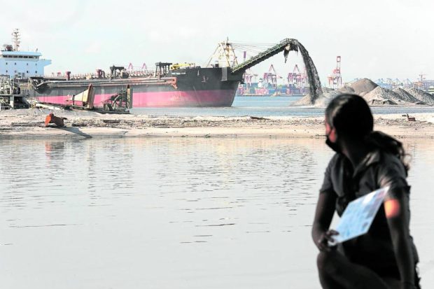
The geologist issued the warning after reviewing the proposed P34-billion Manila Waterfront City Reclamation project, a joint venture agreement that involves the reclamation and development of 318 hectares of foreshore and offshore areas of Manila Bay.
Rodolfo expressed alarm over the scale and breadth of the developments in the bay.
“Despite the clear dangers from land subsidence, storm surges, tsunamis and liquefaction during earthquakes, Manila Bay reclamation is proceeding rapidly,” he said.
He noted that, along with the revival of the mothballed Bataan Nuclear Power Plant, the massive reclamation projects on Manila Bay were among the “biggest human-made threats to the environment” in the country.
‘Very bad idea’
In a peer-reviewed article published in 2014, Rodolfo said land subsidence, or the lowering of the surface closer to sea level, delayed runoff from rains and worsened flooding and tidal occurrences.
This and other reasons were what made near-shore reclamation a “very bad idea,” he said.
Based on his study, coastal areas in Metro Manila were sinking as fast as 9 centimeters every year.
“Caloocan, an industrial area that uses large volumes of groundwater, subsided 8 cm/y in 2004 and 2005,” he said.
Rodolfo said increased pressure from the weight of new buildings in reclaimed areas could also speed up the compression of the surface, resulting in subsidence.
“Coastal areas, whether underlain by natural deposits like those of the Pasig River delta or artificial reclamations, also experience seismically induced liquefaction,” he said, referring to the process that takes place when sediments near bodies of water behave like quicksand.
During earthquakes, the shaking of the ground tends to break the contact between grains of bay-fill materials so buildings on top of sediments could sink or topple over.
“It is therefore very possible that liquefaction during an earthquake would cause the heavy steel pilings to sink deeply into the bay floor, leaving the reclamation without its containment,” he said.
‘Big One’
Rodolfo also cited a 2004 report by the Japan International Cooperation Agency (Jica) which said Metro Manila was overdue for a magnitude 7.2 earthquake, or the “Big One.”
In such a catastrophe, the geologist said the “greatest damage” would likely happen in the shore areas being planned for reclamation.
This is because ground shaking and the likelihood of liquefaction are greater in unconsolidated or partly consolidated sediment present in reclamation sites, he said.
He noted, however, that reclaimed areas in Manila Bay did not need an earthquake to happen to suffer “serious damage.”
In 1968, a magnitude 7.3 earthquake in Casiguran, Quezon province, which was 225 kilometers away from Metro Manila, destroyed many structures near the Pasig River, Rodolfo said.
“The six-story Ruby Tower in Binondo collapsed from amplified ground shaking, liquefaction, or both, killing 260 people,” he said.
The massive magnitude 7.8 earthquake on Feb. 6 that devastated southeastern Turkey and parts of Syria and claimed over 40,000 lives has triggered fresh calls from lawmakers to prepare the country for the next big temblor.
The Jica study made together with the Metropolitan Manila Development Authority also noted that many structures in the National Capital Region and nearby provinces would not able to withstand a magnitude 7.2 earthquake.
Experts believe such a powerful quake may originate from the Marikina Valley Fault System, particularly the West Valley fault line.