
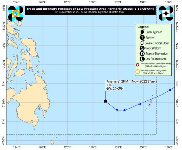
Track and intensity forecast of the low-pressure area, formerly Tropical Depression Queenie. Photo from Pagasa website
MANILA, Philippines — Queenie (international name: Banyan) further weakened from being a tropical depression to a low-pressure area (LPA) on Tuesday.
In its 5 p.m. weather bulletin, the Philippine Atmospheric, Geophysical and Astronomical Services Administration (Pagasa) said Queenie might completely dissolve in the next 12 hours.
“Queenie weakened into a remnant low at 2:00 p.m. today. This remnant low will continue moving generally northwestward and may dissipate in the next 12 hours,” it noted.
At 4 p.m., the LPA was located 420 kilometers east of Hinatuan, Surigao del Sur. It is expected to bring light to moderate with at times heavy rains over Caraga and Davao Oriental.
Meanwhile, the trough of Nalgae, formerly Severe Tropical Storm Paeng, will cause overcast skies with scattered rain showers and thunderstorms over Bataan, Pangasinan, and Zambales.
On the other hand, the rest of the country, including Metro Manila, will experience partly cloudy to cloudy skies with isolated rain showers or thunderstorms because of localized thunderstorms.
Pagasa warned of possible flash floods or landslides due to the weather conditions.
