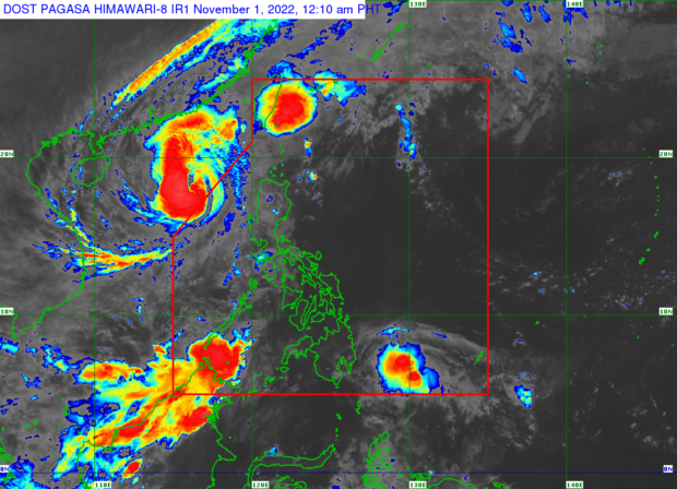
MANILA, Philippines — All wind signals were taken down on Monday as Tropical Storm Paeng, internationally known as Nalgae, continued to move further away from the Philippines, according to the latest bulletin of the Philippine Atmospheric, Geophysical and Astronomical Services Administration (Pagasa).
Paeng was last located 455 km west of Sinait, Ilocos Sur — already outside the Philippine area of responsibility. It had maximum sustained winds of 110 kph near the center and gustiness of up to 135 kph.
Pagasa warned, however, that there would be light to moderate and at times heavy rainfall until Tuesday in Mimaropa, Western Visayas, Zambales, and Bataan due to the trough of Paeng.
Batasan may have strong to gale-force winds due to the northeast monsoon, locally known as “amihan,” are further enhanced by Paeng.
“Though such conditions will likely subside by Wednesday,” Pagasa said.
On Monday night, the National Disaster Risk Reduction and Management Council updated Paeng’s death toll to 101, with 70 reported injuries and 66 missing persons.
More than two million persons were affected by Paeng.
Queenie heads toward PH
Meanwhile, Tropical Storm Queenie has maintained its strength as it headed west-northwest over Eastern Visayas.
It was last located 635 km east of Davao City, with a maximum wind speed of 65 kph and a gustiness of up to 80 kph.
“This tropical cyclone may weaken into a tropical depression tomorrow due to increasingly unfavorable conditions. Further weakening into a low pressure area is likely by Thursday, possibly earlier,” Pagasa said.
Queenie was still expected, however, to bring light to moderate and at times heavy rainfall in Caraga, Eastern Visayas, and Davao Oriental until Wednesday.
Pagasa said that it had not yet ruled out raising wind signals, particularly, over the eastern portion of Caraga and in some areas in Eastern Visayas by Tuesday evening.
“The highest wind signal that will likely be hoisted is Wind Signal No. 1,” Pagasa said.