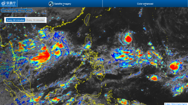
‘Karding’ intensifies into tropical storm

‘Karding’ intensifies into a tropical storm as it continues to move toward the country. | Photo from Japan Meteorological Agency
MANILA, Philippines — Tropical depression “Karding” intensified into a tropical storm category on Thursday afternoon, said the Philippine Atmospheric, Geophysical and Astronomical Services Administration (Pagasa).
However, it currently has no direct effect on the country as it is still located 1,320 kilometers east of Northern Luzon as of 4 p.m., said Pagasa weather specialist Raymond Ordinario.
It carries maximum wind speeds of 65 kilometers per hour (kph) and gusts of up to 80 kph.
“Dahil nga sa kalayuan ng bagyong si Karding ay wala itong direktang epekto sa ano mang bahagi ng ating kapuluan,” said Ordinario.
Article continues after this advertisement(Due to the distance of typhoon Karding, it has no direct impact on any part of our archipelago.)
Article continues after this advertisement“At sa ngayon wala pa tayong nakataas na gale warning sa ano mang bahagi ng ating baybayin,” he added.
(And so far, we have not raised a gale warning on any part of our coast.)
Ordinario warned that based on its current track, Karding is expected to make landfall in the country’s land mass by Sunday.
If it does hit the country, Karding is expected to bring heavy rains over Northern and Central Luzon starting late Saturday or Sunday morning.
Due to this, the possibility of tropical cyclone wind signals (TCWS) being raised over Northern and Central Luzon remains high — with the highest possible signal being signal no. 3.
“Localities situated in the eastern portions of Northern and Central Luzon may be placed under TCWS #1 as early as Friday evening or Saturday early morning,” said Ordinario.