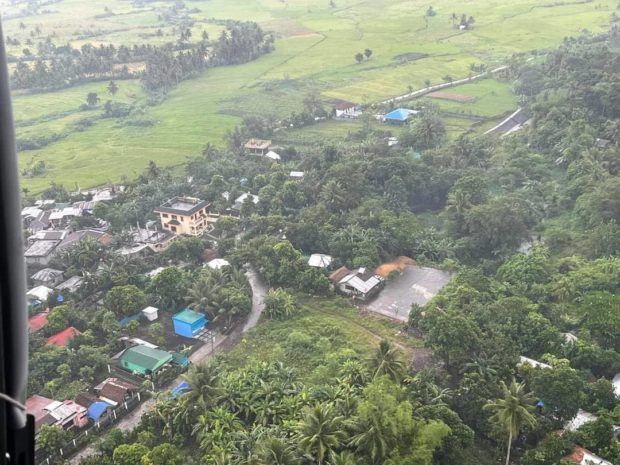
In this aerial assessment on September 10, 2022, a school building, new residential houses, and concrete roads were found inside the six-kilometer permanent danger zone of Mt. Mayon. (Photo courtesy of OCD)
LIGAO CITY — Local disaster officials have expressed alarm over the new structures that were built around Mt. Mayon, particularly inside the six-kilometer permanent danger zone.
Gremil Alexis Naz, spokesperson for the Office of Civil Defense (OCD) in Bicol, said an aerial assessment was made by his office, along with the Albay Public Safety Emergency Management Office (Apsemo) and the Philippine Air Force, on Saturday, September 10.
Naz said a school building, new residential houses, and concrete roads were erected in different municipalities around the volcano.
Claudio Yucot, Bicol director of OCD, said his office would coordinate with the Albay provincial disaster risk reduction and management council to address the issue.
“I am alarmed by these developments (newly built structures) and we will ask the local governments to evaluate and revisit their contingency plans related to Mt. Mayon,” he said.
According to Dr. Cedric Daep, chief of Apsemo, the aerial assessment would help them come up with an evacuation plan in case the volcano erupts.
“The aerial survey will just give us an idea in validating the exact location and distance from the 6-km danger zone through ground survey,” Daep told the Inquirer over the phone.
Dr. Paul Karson Alanis, resident volcanologist, said only two volcanic earthquakes and four rockfall events were recorded around Mt. Mayon since Alert Level 1 was hoisted over the area on August. 21. INQ
RELATED STORIES
No volcanic quakes, but Mayon still in abnormal condition – Phivolcs
Albay bans activities inside Mayon Volcano danger zone
Mt. Mayon registers 3 volcanic quakes, remains at Alert Level 0, says Phivolcs