MANILA, Philippines — 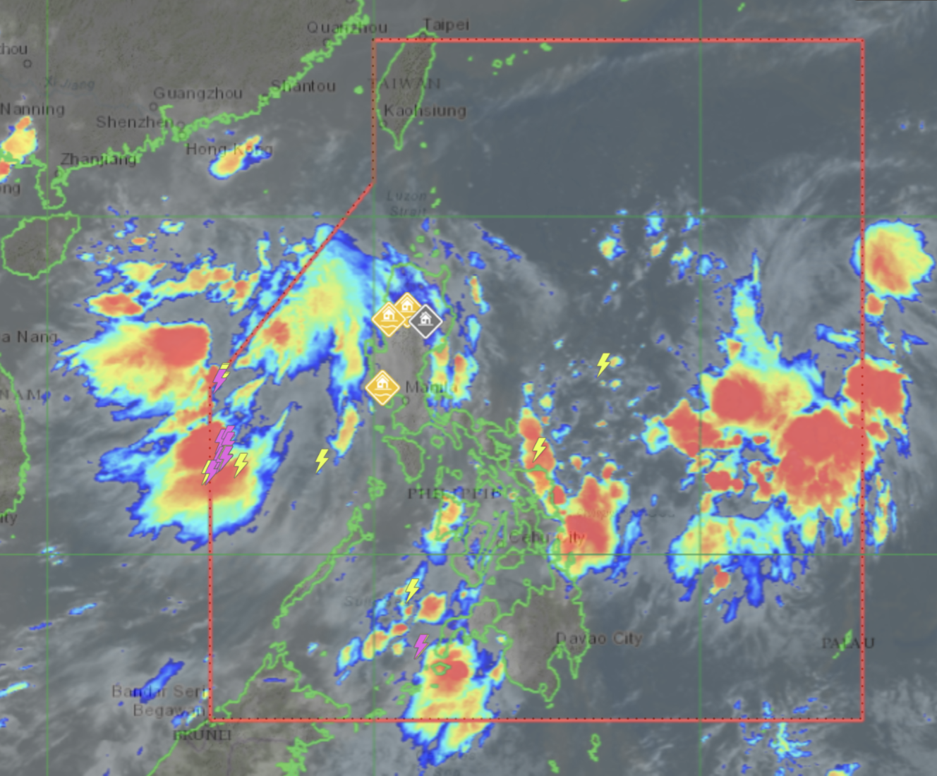
A low pressure area (LPA) sighted some 1,325 kilometers east of Central Luzon may intensify into a tropical cyclone, the state weather bureau said on Friday.
The Philippine Atmospheric, Geophysical and Astronomical Services Administration (Pagasa), however, added that the LPA is not yet expected to directly affect the country.
“Most likely po itong low pressure area na ito, sa ngayon, ay walang direktang epekto sa anumang bahagi ng ating bansa, pero itong LPA na ito ay may posibilidad na mag-develop into a tropical cyclone. So umantabay tayo sa mga updates na ilalabas ng Pagasa ukol sa weather disturbance na ito,” said Pagasa weather specialist Ezra Bulquerin in the bureau’s public weather forecast.
(This LPA will not yet directly affect any part of the country, but it has a possibility of becoming a tropical cyclone. The public is advised to monitor weather updates.)
Another LPA some 365 kilometers west of Calayan, Cagayan, is expected to exit the Philippine area of responsibility and is not likely to affect the country, added Bulquerin.
Friday forecast
Cloudy skies with rain showers and thunderstorms due to the southwest monsoon or “habagat” are expected in the provinces of Pangasinan, Zambales and Bataan, Pagasa said.
Metro Manila and the rest of the country will experience partly cloudy to cloudy skies with isolated rain showers due to the southwest monsoon and localized thunderstorms.
Pagasa warned of possible flash floods and landslides but did not raise any gale warnings.
Forecast temperature range in key cities / areas on Friday:
- Metro Manila — 25 to 32 degrees Celsius
- Baguio — 16 to 21 degrees Celsius
- Laoag — 24 to 31 degrees Celsius
- Tuguegarao — 25 to 32 degrees Celsius
- Legazpi — 25 to 31 degrees Celsius
- Puerto Princesa — 25 to 32 degrees Celsius
- Tagaytay — 22 to 30 degrees Celsius
- Kalayaan Islands — 26 to 32 degrees Celsius
- Iloilo — 26 to 32 degrees Celsius
- Cebu — 25 to 32 degrees Celsius
- Tacloban — 26 to 32 degrees Celsius
- Cagayan de Oro — 23 to 30 degrees Celsius
- Zamboanga — 24 to 33 degrees Celsius
- Davao — 25 to 33 degrees Celsius