

Pagasa weather satellite image as of 9:50a.m.
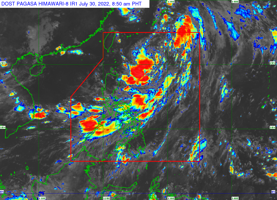
MANILA, Philippines — Tropical Depression “Ester” is expected to exit the Philippine area of responsibility (PAR) on Saturday afternoon, said the Philippine Atmospheric, Geophysical and Astronomical Services Administration (Pagasa), but the southwest monsoon will still bring rain over several parts of the country.
According to Pagasa weather specialist Ezra Bulquerin in a weather report Saturday morning, Ester was last spotted 785 east of Itbayat, Batanes, maintaining its strength with wind speeds at 54 kilometers per hour (kph) and gusts of up to 55 kph
“May kabagalan na po ang pagkilos nito, pero inaasahan natin na mamayang hapon nasa labas na po ito ng Philippine area of responsibility,” said Bulquerin.
(It is currently moving slowly, but we expect that by this afternoon it will be outside the Philippine area of responsibility.)
No tropical cyclone wind signals are hoisted over the country, said Bulquerin, as it no longer has any direct impact on the country.
The southwest monsoon, locally known as the “habagat,” however, will continue to bring rain over Southern Luzon and Western Visayas.
“Cloudy skies with scattered rain showers and thunderstorms are expected over Metro Manila, Calabarzon, Mimaropa, Bicol Region, Zambales, Bataan, Aklan, Antique, and Samar Provinces,” said Bulquerin.
“Pero sa nalalabing bahagi ng bansa, fair weather conditions especially diyan sa area ng Mindanao, at remaining areas ng Luzon,” he added.
(But in the rest of the country, fair weather conditions especially in the area of Mindanao, and remaining areas of Luzon.)
No gale warning was raised by Pagasa, but moderate to strong sea conditions are expected over the northern and eastern seaboards of the country, with waves ranging from 1.2 to 2.8 meters.
RELATED STORY:
LPA off northern Luzon develops into Tropical Depression Ester
