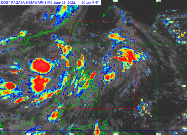
Image from PAGASA
MANILA, Philippines — Tropical Depression Caloy slightly intensified as it remained above the West Philippine Sea on its way to exit the Philippine Area of Responsibility (PAR), said Philippine Atmospheric, Geophysical and Astronomical Services Administration (Pagasa).
According to Pagasa, as of 10:00 p.m., Caloy was last located 430 km west of Iba, Zambales moving westward slowly with a maximum wind speed of 55 kph and a gustiness reaching up to 70 kph.
While set to become a tropical storm in the next 24 hours, Caloy is also expected to exit PAR within the same period, passing just beyond PAR by 8:00 a.m. on June 30.
As of this writing, no tropical cyclone wind signal is hoisted over any part of the country, but the southeast monsoon, locally known as the “habagat,” is expected to strengthen.
It’s expected to bring moderate to heavy rains over Palawan, Oriental Mindoro, Occidental Mindoro, Aurora, Quezon, Zambales, Bataan, Cavite, Batangas, and Laguna.
Meanwhile, light to moderate, to at times heavy rain is expected over Metro Manila, the rest of Mimaropa, Rizal, Tarlac, Pampanga, Ilocos Region, Bicol Region, and Western Visayas.
Pagasa warned that the two weather systems will cause moderate to rough sea conditions in the seaboards of Northern Luzon and the western seaboard of Central and Southern Luzon.
Wave height could reach 1.5 to 3.7 meters.
RELATED STORIES
PH may have 15 cyclones from July to December – Pagasa