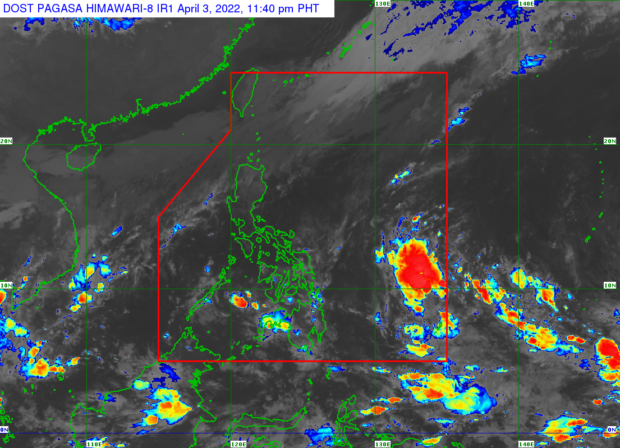
Low pressure area east of Visayas spotted
MANILA, Philippines — A low pressure area (LPA) east of Visayas is expected to enter the Philippine area of responsibility on Monday.
The low pressure area was spotted 1,210 kilometers east of Visayas, the Philippine Atmospheric, Geophysical and Astronomical Services Administration said on Sunday afternoon.
But the weather disturbance is unlikely to strengthen into a tropical cyclone but is expected to cross Mindanao, Visayas and Palawan in the next few days.
Two weather systems are currently affecting the country, Pagasa said.
A shear line will bring cloudy skies with scattered rain and thunderstorms in Cagayan Valley, Apayao, and Ilocos Norte on Monday.
Moderate to heavy rain are expected in parts of Visayas, Mindanao, Masbate, and Sorsogon due to an intertropical convergence zone. Metro Manila and the rest of Luzon will have fair weather with chances of isolated rain and thunderstorms.
—FRANCES MANGOSING
RELATED STORY
Pagasa: LPA off E. Samar enters PAR; isolated rain showers expected
