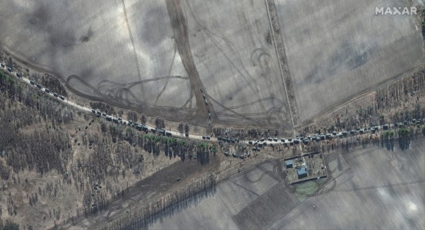
One of the satellite images shows southern end of convoy armor towed artillery trucks, east of Antonov airport, Ukraine, February 28, 2022. Satellite image ©2022 Maxar Technologies/Handout via REUTERS
WASHINGTON — Satellite images taken on Monday show a Russian military convoy north of the Ukrainian capital of Kyiv that stretches for about 40 miles (64 km), substantially longer than the 17 miles (27 km) reported earlier in the day, a U.S. private company said.
A satellite image shows ground forces equipment and a convoy, in Khilchikha, Belarus February 28, 2022. Satellite image 2022 Maxar Technologies/Handout via REUTERS
RELATED STORY:
Maxar Technologies also said additional ground forces deployments and ground attack helicopter units were seen in southern Belarus, less than 20 miles (32 km) north of the Ukraine border.
Russian forces appear to shift to siege warfare in Ukraine — US official