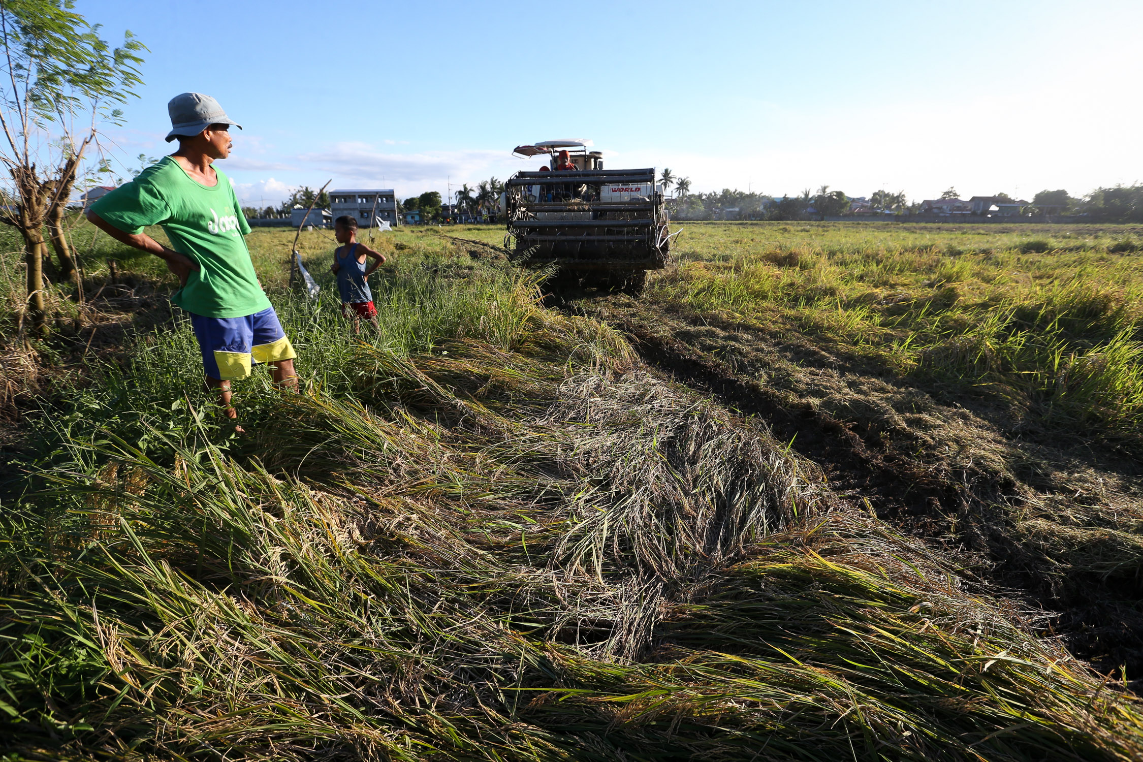
NOVEMBER 19, 2020A farmer in Barangay Dulong Malabon, Pulilan, Bulacan watches a harvester machine reaping palay flattened by strong winds and heavy rain caused by Typhoon Ulysses. Agriculture damage and production losses has risen to almost P4 billion in the wake of this recent typhoon. INQUIRER PHOTO/LYN RILLON
MANILA, Philippines — La Niña may persist well until April, the Philippine Atmospheric, Geophysical, and Astronomical Services Administration (Pagasa) reported Sunday.
“La Niña” is a weather phenomenon characterized by unusually cool ocean surface temperatures in the central and eastern equatorial Pacific.
The onset of La Niña, which had magnified the effects of extreme weather in the country, was pronounced in October 2021.
“Maaaring magtagal ang La Niña hanggang sa April 2022 and pagsapit po ng Mayo ay maaari na ring bumalik sa neutral conditions,” Pagasa weather specialist Benison Estareja said.
(La Niña may continue until April 2022 and by May, it may return to neutral conditions.)
“So, ibig sabihin po, sa susunod na tatlong buwan ay posible pa ring makaranas ang majority ng ating bansa ng higit sa normal na dami ng pag-ulan,” he added.
(This means that in the next three months, it is possible for the majority of the country to experience above-normal rainfall.)
In February, parts of Mindanao and Eastern Visayas may have above normal rainfall, Estareja said.
Meanwhile, rainfall may be below normal and way below normal over Ilocos Region, Cordillera Administrative Region, Central Luzon, Occidental Mindoro, and Palawan.
From February to May, the expected number of tropical cyclones that may enter the Philippine Area of Responsibility is a maximum of one per month, said Estareja.