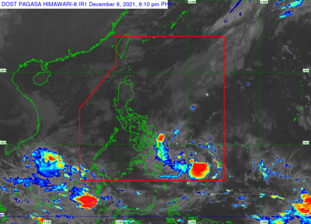
MANILA, Philippines — A low-pressure area (LPA) located east of Davao City will bring rain to parts of Visayas and Mindanao on Tuesday, said the Philippine Atmospheric, Geophysical and Astronomical Services Administration (Pagasa).
According to Pagasa weather specialist Ana Clauren, the LPA was first detected at 8:00 a.m. Monday, and was last spotted 735 kilometers east of Davao City.
“Itong LPA na ito ay mababa po ang tiyansa na maging isang bagyo ngunit inaasahan nating makakaapekto ito dito sa may bahagi ng Eastern Visayas, Northen Mindanao, Caraga, Davao Region pati na rin sa Bohol,” said Clauren.
She added that scattered rain showers are expected over the mentioned areas along with the effects of the shear line.
Meanwhile, the northeast monsoon, locally known as “amihan,” will bring cloudy skies and light rains over Eastern Luzon.
On the other hand, the rest of the country, including Metro Manila, will experience fairer weather but chances of rain during the afternoon and evening remain.
The temperature range in key cities/areas according to Pagasa for Tuesday:
Metro Manila: 20 to 29 degrees Celsius
Baguio City: 11 to 20 degrees Celsius
Laoag City: 21 to 29 degrees Celsius
Tuguegarao: 19 to 25 degrees Celsius
Legazpi City: 23 to 30 degrees Celsius
Puerto Princesa City: 24 to 31 degrees Celsius
Tagaytay: 17 to 26 degrees Celsius
Kalayaan Islands: 25 to 31 degrees Celsius
Iloilo City: 24 to 29 degrees Celsius
Cebu: 25 to 38 degrees Celsius
Tacloban City: 24 to 29 degrees Celsius
Cagayan De Oro City: 24 to 28 degrees Celsius
Zamboanga City: 23 to 34 degrees Celsius
Davao City: 24 to 30 degrees Celsius
Gale warning is also raised in several coasts of the country, said Pagasa’s Clauren, specifically over the seaboards of Northern Luzon, Central Luzon and eastern seaboards of Southern Luzon, Visayas and Mindanao.
Clauren said that waves in these areas might reach as high as 4.5 meters.
