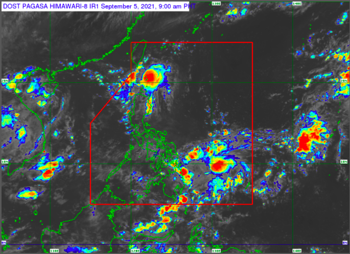
Pagasa weather satellite image as of 9 AM Sunday, Sept. 5, 2021
MANILA, Philippines — The Philippine Atmospheric, Geophysical and Astronomical Services Administration (Pagasa) is monitoring a low pressure area (LPA) off Surigao del Sur.
Pagasa spotted the LPA 785 kilometers east northeast of Hinatuan, Surigao del Sur.
The state weather bureau, however, said that it is less likely to develop into a tropical cyclone within 24 hours.
“Ayon nga po sa ating latest analysis, sa ating latest available data, ito nga pong low pressure area na ito ay less likely ma-develop within 24 hours. Ngunit, continuous monitoring po tayo at patuloy po tayong mag-antabay sa updates na papalabas po ng Pagasa ukol nga po sa weather disturbance na ito,” Pagasa weather specialist Grace Castañeda noted.
(Based on our latest analysis, latest available data, this low pressure area is less likely to develop within 24 hours. But, we are continuously monitoring it. Wait for updates that Pagasa will release regarding this weather disturbance.)
Based on Pagasa’s 24-hour public weather forecast, the monsoon trough will continue to prevail over the country.
Batanes and Babuyan Islands will have cloudy skies with scattered rain showers and thunderstorms.
The rest of the country, on the other hand, will experience partly cloudy to cloudy skies with isolated rain showers or thunderstorms.
Moreover, the country’s coastal waters will be slight to moderate with a wave height of 0.6 to 2.1 meters.
“Wala din po tayong nakataas na gale warning kaya malayang makakapalaot ‘yung ating mga kababayang mangingisda pati na rin ‘yung may maliliit na sasakyang pandagat,” Castañeda said.
(We do not have a raised gale warning, so our fisherfolk and those with small fishing vessels may freely go to the seas.)