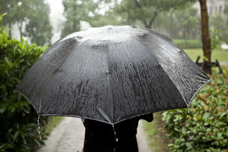

MANILA, Philippines — The easterlies will bring scattered rain and thunderstorms in Bicol, Quezon, and Mimaropa while generally fair weather is expected to continue in the rest of country, including Metro Manila in the next 24 hours, said the Philippine Atmospheric, Geophysical and Astronomical Services Administration (Pagasa).
Isolated rain showers caused by localized thunderstorms, however, may still occur during the afternoon and evening, said Pagasa weather specialist Joey Figuracion.
“Bukas generally ‘yung malaking bahagi ng Luzon ay fair weather condition, pero ‘yung easterlies ay magdadala pa rin ng kalat-kalat na pag-ulan at thunderstorms sa Bicol, sa Quezon, at Mimaropa except sa Kalayaan Islands,” said Figuracion.
(Majority of Luzon will have fair weather conditions, but the easterlies will still bring scattered rains and thunderstorms to Bicol, Quezon, and Mimaropa except in Kalayaan Islands.)
“At sa nalalabing bahagi ng Luzon kasama ang Metro Manila, mainit at maalinsangan ang tanghali at afternoon pero may tiyansa ng pagulan bandang hapon hanggang madaling araw, pero pulo pulo o panandaliang ulan lamang ‘yan,” he added.
(While the rest of Luzon including Metro Manila will experience hot and humid weather with a chance of short-lived rains in the afternoon until dawn.)
The entire Visayas and Mindanao will also experience similar weather conditions with the same chance for short scattered rain in the afternoon and evening due to localized thunderstorms.
Meanwhile, Pagasa said it is currently monitoring a low-pressure area (LPA) that is expected to enter the Philippine Area of Responsibility on Thursday or Friday.
The LPA was last spotted 2,075 km east of Southern Luzon as of 3 p.m. and is expected to become a storm in the next 24 to 48 hours.
“May posibilidad na papasok, pero hindi naman po ito inaasahan pa o mababa pa ang tiyansa na makaapetko direkta sa ano mang bahagi ng ating bansa,” said Figuracion.
(There is a possibility of entry, but it is not expected to directly affect any part of our country.)
“Mababa ang tiyansa na magcross sa land mass o kalupaan,” he added.
(Its chances of crossing the country’s land mass is low.)
Pagasa forecast temperature range in key cities/areas for the next 24 hours:
Metro Manila: 25 to 32 degrees Celsius
Baguio City: 16 to 24 degrees Celsius
Laoag City: 25 to 32 degrees Celsius
Tuguegarao: 23 to 34 degrees Celsius
Legazpi City: 25 to 32 degrees Celsius
Puerto Princesa City: 26 to 32 degrees Celsius
Tagaytay: 21 to 31 degrees Celsius
Kalayaan Islands: 27 to 34 degrees Celsius
Iloilo City: 26 to 33 degrees Celsius
Cebu: 25 to 32 degrees Celsius
Tacloban City: 25 to 32 degrees Celsius
Cagayan De Oro City: 23 to 33 degrees Celsius
Zamboanga City: 24 to 33 degrees Celsius
Davao City: 25 to 33 degrees Celsius
According to Figuracion, no gale warning is currently raised in the country’s coasts as only slight to moderate sea conditions are expected across the Philippine seaboards.