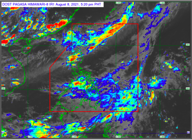
MANILA, Philippines — The low-pressure area now inside the Philippine Area of Responsibility (LPA) will cause rains on Monday in the Bicol region and in many parts of Visayas and Mindanao.
The Philippine Atmospheric, Geophysical and Astronomical Services Administration (Pagasa) said the LPA was last spotted 855 km east of Visayas as of 3:00 p.m. on Sunday.
“Bagamat maliit ang tiyansa nito na maging bagyo within 12-24 hours, yung trough o extension ng ating low pressure area ay magdudulot ng maulap na kalangitan, mga pag-ulan at pulu-pulong pagkidlat at pagkulog sa buong Visayas at Mindanao ngayong gabi,” senior weather specialist Chris Perez said.
(While there is a small chance of the LPA becoming a typhoon within 12-24 hours, the trough or extension of the low-pressure area will cause cloudy skies, isolated rains, and thunderstorms in Visayas and Mindanao tonight.)
Rainy weather will still persist in Bicol region, Eastern and Central Visayas, as well as in the Davao region on Monday due to the LPA’s trough, Pagasa said.
In Luzon, Batanes, and the Babuyan Islands will experience cloudy skies with scattered rains due to the southwest monsoon or habagat.
Metro Manila and the rest of the country will experience fair weather with chances of isolated rains and thunderstorms.
There are no gale warnings raised in any of the country’s waters on Monday, said Pagasa.
The coastlines of Luzon and Visayas will be moderate to strong waves from 1.2 to 3.4 meters, while Mindanao will have slight to moderate waves at 0.6 to 2.1 meters.
