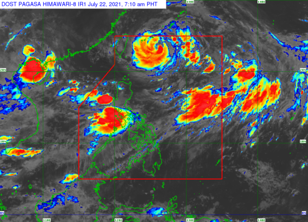
Weather satellite image from Pagasa
MANILA, Philippines — Tropical Storm Signal No. 1 remained hoisted over Batanes and Babuyan Islands as the typhoon-enhanced southwest monsoon will continue to bring rains over most parts of the country on Thursday, the state weather bureau said.
Typhoon Fabian (international name In-Fa) was last spotted 535 kilometers northeast of Itbayat, Batanes, blowing maximum sustained winds of 150 kilometers per hour near the center and gusts of up to 185 kph, the Philippine Atmospheric Geophysical and Astronomical Services Administration said.
The weather disturbance was moving west-northwest at 10 kph.
Fabian is unlikely to directly dump rains in the country, but it continues to enhance the southwest monsoon, locally known as habagat, and bring rains over Ilocos Region, Abra, Benguet, Zambales, Bataan, Tarlac, Pampanga, Bulacan, Metro Manila, Cavite, Batangas, Occidental Mindoro, Oriental Mindoro, Romblon, and the northern portion of Palawan including Calamian and Kalayaan Islands.
READ: Typhoon Fabian keeps strength; monsoon rain to continue over Metro Manila, parts of Luzon
The typhoon is expected to make landfall in the southern Ryuku archipalego on Friday, and leave the Philippine area of responsibility by early Saturday, Pagasa said.
Fabian may start to weaken over the weekend and accelerate by Sunday as it makes landfall over mainland China.
RELATED STORES
Over 130 evacuated as rain spawned by Fabian floods Occidental Mindoro town
Two cyclones enhance ‘habagat’