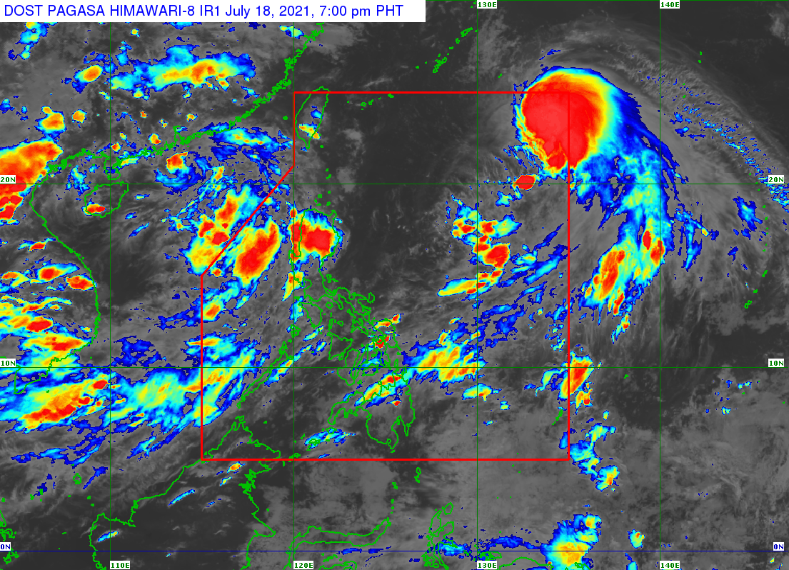
MANILA, Philippines — The low-pressure area (LPA) outside the Philippine Area of Responsibility (PAR) has turned into a tropical depression, while Tropical Storm Fabian is expected to exit PAR on Tuesday, the state weather service said Sunday.
The Philippine Atmospheric, Geophysical and Astronomical Services Administration (Pagasa) said the tropical depression located 770 kilometers west of Basco, Batanes is moving northwestward with maximum sustained winds of 45 kilometers per hour (kph) and gusts up to 55 kph.
Fabian, meanwhile, is expected to be at 1,095 kilometers east northeast of extreme Northern Luzon by Monday, and is expected to exit the PAR on Tuesday afternoon.
While Fabian is far from the country’s landmass, and the tropical depression is still outside of the PAR, the entire Luzon and many parts of the country, will expect rainy weather, Pagasa said.
Metro Manila and the rest of Luzon, along with Central Visayas, Western Visayas, Northern Mindanao, the Zamboanga Peninsula, Tawi-Tawi, Sulu, and Basilan are expected to experience cloudy skies with isolated rain showers due to the southwest monsoon or habagat.
The rest of the Visayas and Mindanao, meanwhile, should expect fair weather with chances of rain due to isolated thunderstorms.
While there are no gale warnings raised in the country’s waters, Southern Luzon and the Visayas are expected to have moderate to strong sea conditions, while the rest of Luzon and Mindanao expect light to moderate sea conditions.
