LPA east of PH is now TD Fabian; southwest monsoon likely to intensify

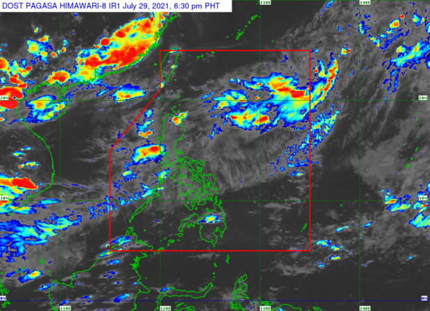
Pagasa weather satellite image
MANILA, Philippines — The low-pressure area spotted east of the country has already intensified into a tropical depression and was given the local name Fabian, the Philippine Atmospheric, Geophysical and Astronomical Services Administration (Pagasa) said Friday afternoon.
Based on Pagasa’s latest bulletin, Fabian was last located 1,345 kilometers east of Northern Luzon, packing maximum sustained winds of 45 kilometers (kph) per hour near the center and gustiness of up to 55 kph. It is moving northwestward at a slow pace.
According to Pagasa’s forecast track, Fabian would strengthen into a tropical storm by Sunday afternoon, when it starts to sharply turn towards the western side of the country. By Monday it would move closer to the northern border of the Philippine area of responsibility (PAR).
Pagasa expects Fabian to intensify further and become a severe tropical storm by Tuesday afternoon before it exits the PAR — which means it is not likely to hit any landmass in the country.
However, the state weather bureau said Fabian may enhance the southwest monsoon (locally known as habagat) and bring rain over a broad portion of the Luzon and Visayas regions.
Article continues after this advertisementSpecifically, Pagasa said an enhanced habagat will cause heavy rains over parts of Mimaropa, Calabarzon, Western Visayas, Metro Manila, Bataan, and Zambales starting Sunday, July 18.