TD Emong accelerates as it approaches Batanes-Babuyan Islands area
MANILA, Philippines — Tropical Depression Emong on Monday increased speed as it moved towards the Batanes-Babuyan Islands area, the state weather service said.
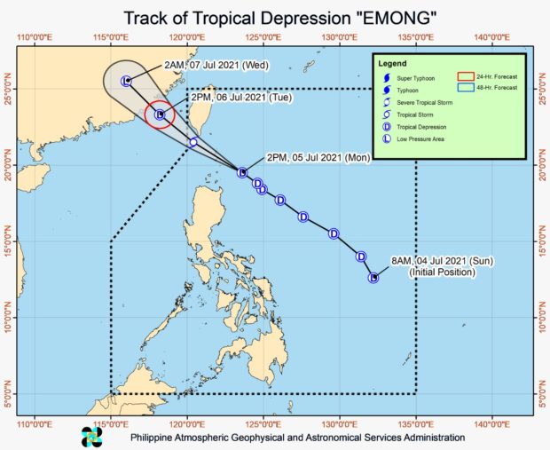
In its 5 p.m. severe weather bulletin, the Philippine Atmospheric, Geophysical, and Astronomical Services Administration (Pagasa) said Emong was last spotted 215 kilometers east-northeast of Calayan, Cagayan, or 160 km east-southeast of Basco, Batanes.
It is packing maximum sustained winds of 55 km per hour near the center and gustiness of up to 70 kph, moving northwestward at 45 kph, it added.
Pagasa said Emong may also intensify into a tropical storm within the next 12 hours, and “will pass close or make landfall in the vicinity of Batanes-Babuyan Islands area” between 6 p.m. and 10 p.m. Monday night.
Article continues after this advertisementTropical Cyclone Warning Signal (TCWS) No. 1 is still raised over Batanes and the northeastern portion of Cagayan (Santa Ana, Gonzaga), including Babuyan Islands, where “winds of 30 to 60 kph may be expected in at least 36 hours or intermittent rains may be expected within 36 hours,” Pagasa noted.
Article continues after this advertisementIt also said the tropical depression is expected to bring moderate to heavy with at times intense rains over Batanes and Babuyan Islands “today through tomorrow morning.”
Pagasa then warned that “isolated to scattered flash flooding and rain-induced landslides are highly likely especially in areas with high or very high susceptibility to these hazards as identified in hazard maps. Adjacent or nearby areas may also experience flooding in the absence of such rainfall occurrence due to surface runoff or swelling of river channels.”
“Areas where TCWS No. 1 is hoisted will be experiencing strong winds (a strong breeze to near gale) during the passage of the tropical depression. However, the projected track and intensity suggests the possibility of hoisting TCWS No. 2 over portions of the localities presently under TCWS No. 1,” it added.
Rough to very rough seas will likewise be experienced over the seaboards of areas under Signal No. 1 and the remaining seaboard of Cagayan, according to the weather bureau.
Thus, sea travel is risky over these waters, especially for those using small seacrafts, it said, adding that mariners without the proper experience should immediately seek safe harbor.
Pagasa said Emong may possibly leave the Philippine Area of Responsibility on the early morning of Tuesday. It will continue moving northwestward towards Fujian, China.
Pagasa said after passing south of southern Taiwan, Emong may weaken into a tropical depression due to its interaction with the rugged terrain, and may further weaken into a remnant low as it moves further inland over Jiangxi, China.