Tropical Storm Dante to make landfall over Eastern Samar Tuesday night
MANILA, Philippines — Tropical Storm Dante (international name: Choi-wan) is poised to make landfall on the northern portion of Eastern Samar, the state weather service said on Tuesday night.
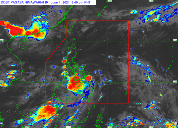
In its 8 p.m. severe weather bulletin, the Philippine Atmospheric, Geophysical, Astronomical, and Services Administration (Pagasa) said Dante is expected to hit land over Eastern Samar between 8 p.m. and 11 p.m. June 1.
It will then pass through the eastern portion of Northern Samar and emerge above the coastal waters of Northern Samar before it makes its second landfall over Sorsogon or Rapu-Rapu Island, Pagasa added.
As of 7 p.m., Dante was located 55 kilometers east-northeast of Borongan City, Eastern Samar, packing maximum sustained winds of 65 km per hour (kph) and gustiness of up to 80 kph.
It is moving northwestward at 30 kph, Pagasa said.
Tropical Cyclone Wind Signal (TCWS) No. 2 was hoisted over the following areas:
Luzon
- southern portion of Quezon (Calauag, Tagkawayan, Guinayangan, Lopez, Buenavista, Catanauan, San Narciso, Mulanay, San Andres, San Francisco, General Luna, Gumaca, Macalelon, Pitogo, Quezon)
- Catanduanes
- Camarines Norte
- Camarines Sur
- Masbate including Ticao and Burias Island
- Albay
- Sorsogon
Visayas
- Eastern Samar
- Samar
- Northern Samar
- Biliran
- northeastern portion of Leyte (Carigara, Barugo, San Miguel, Babatngon, Tacloban City, Alangalang, Tunga, Santa Fe, Palo)
Meanwhile, the following areas are under Signal No. 1:
Luzon
- Aurora
- eastern portion of Nueva Ecija (Bongabon, Laur, Gabaldon, General Tinio, Palayan City)
- eastern portion of Bulacan (Doña Remedios Trinidad, Norzagaray)
- Rizal
- Laguna
- southeastern portion of Batangas (Lobo, San Juan, Rosario, Taysan, City of Tanauan, Santo Tomas, Malvar, Lipa City, Padre Garcia, Ibaan, Batangas City, Balete, Mataasnakahoy, San Jose)
- the rest of Quezon, including Polillo Islands
- Marinduque
- Romblon
Visayas
- northeastern portion of Aklan (Lezo, Numancia, Banga, Kalibo, New Washington, Balete, Batan, Altavas, Makato, Tangalan)
- northeastern portion of Capiz (Mambusao, Sapi-An, Ivisan, Roxas City, Panitan, Sigma, Panay, Pontevedra, President Roxas, Pilar, Ma-Ayon, Dao, Cuartero)
- northeastern portion of Iloilo (Sara, San Dionisio, Batad, Estancia, Balasan, Carles, Lemery, Ajuy, Concepcion)
- the northeastern portion of Negros Occidental (Manapla, Cadiz City, Sagay City, City of Escalante, Toboso, City of Victorias, Calatrava)
- northern portion of Cebu (Balamban, Asturias, Tuburan, Tabuelan, Sogod, San Remigio, City of Bogo, Borbon, Tabogon, Daanbantayan, Medellin, Catmon, Danao City, Carmen, Compostela, Cebu City, Liloan, Consolacion, Mandaue City, Lapu-Lapu City, Cordova) including Camotes and Bantayan Islands
- northeastern potion of Bohol (Getafe, Talibon, Trinidad, Bien Unido, Ubay, San Miguel, Alicia, Buenavista, Mabini, Candijay, Anda, Inabanga, Guindulman, Dagohoy, Pilar, Danao, Pres. Carlos P. Garcia)
- Southern Leyte
Mindanao
- Surigao del Norte including Siargao and Bucas Grande Islands
- Dinagat Island
- northern portion of Agusan del Norte (Kitcharao, Jabonga)
- northern portion of Agusan del Sur (Sibagat)
- northern portion of Surigao del Sur (Cantilan, Carrascal)
Pagasa said Dante may weaken into a tropical depression on Thursday and become a low-pressure area by Friday afternoon.