


Tropical Storm Surigae still outside PAR, but trough affecting eastern Visayas, Mindanao
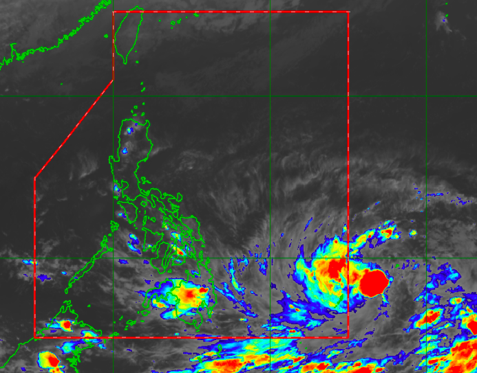
Satellite image from Himawari IR1 via Pagasa
MANILA, Philippines — Tropical Storm Surigae remains outside the Philippine area of responsibility (PAR) but state meteorologists say that the effects of its trough may extend to eastern portions of Visayas and Mindanao.
Latest updates from the Philippine Atmospheric, Geophysical and Astronomical Services Administration (Pagasa) on Wednesday afternoon showed Surigae was 1,195 kilometers east of Mindanao, packing maximum sustained winds of 75 kilometers per hour (kph) and gustiness of up to 90 kph.
It was moving northwest at a speed of 10 kph and is expected to enter PAR a bit earlier, around Friday morning, as a Typhoon-category storm.
It would be given the local name “Bising” once it enters PAR.
After entering Philippine waters, it would then continue its northwestward track and is expected to be located 710 kilometers east of Guiuan, Eastern Samar, by Saturday morning.
On Sunday morning it would then be closest to the country’s landmass, at around 590 kilometers east of Juban, Sorsogon. It is then seen to recurve starting Monday morning, where it may be 725 kilometers east of Infanta, Quezon.
Although Pagasa is not expecting a landfall scenario, parts of Eastern Samar and the Bicol region already fall within the cone of probability. But while these areas are not on the predicted track, they are still less likely to be hit by a possible typhoon.
Still, the weather bureau has advised local government units nearest the storm’s path to take necessary precautions.
“The public and DRRM (Disaster Risk Reduction Management) offices, especially in the eastern portions of Southern Luzon and the Visayas, are advised to continuously monitor for updates,” Pagasa said.
“Considering the uncertainty in the track forecast, a westward shift in the current track may result in potentially significant impacts over the aforementioned areas over the weekend onto Monday,” it added.
The weather is expected to be fair on Thursday when temperatures in Metro Manila, Laoag, and Tagaytay will range between 24 and 33 degrees Celsius.
Both Visayas and Mindanao may continue to experience warm and humid days, despite the possibility of severe thunderstorm activity over the regions’ eastern portions. Iloilo will experience temperatures between 25 and 32 degrees Celsius, Cebu will experience temperatures between 25 and 31 degrees, Tacloban will experience temperatures between 26 and 32 degrees, Zamboanga will experience temperatures between 24 and 35 degrees, Cagayan de Oro will experience temperatures between 24 and 31 degrees, and Davao will experience temperatures between 25 and 33 degrees.
Surigae will affect the country’s eastern waters though no gale warnings have been issued yet. Meanwhile, the rest of the country’s seas are expected to have a slight to moderate condition.


