Storm Auring maintains strength; heavy rains due in parts of Visayas, Mindanao
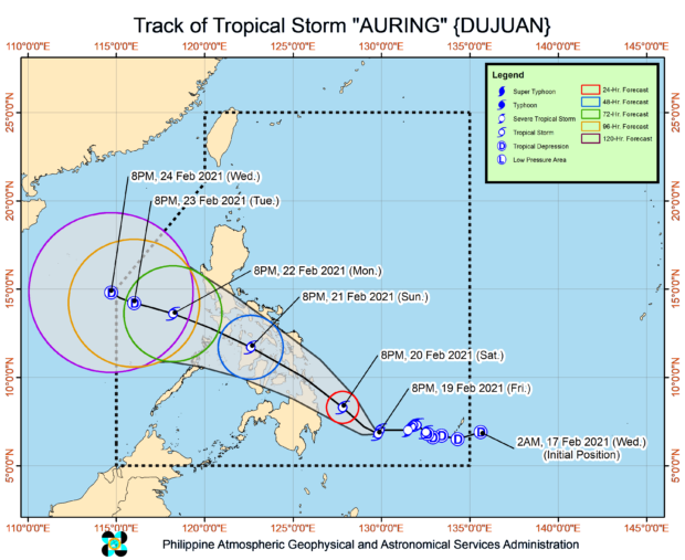
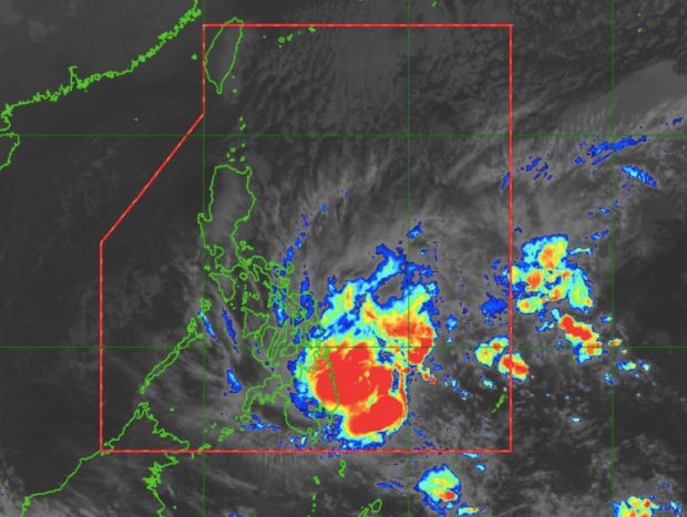
MANILA, Philippines — Tropical Storm Auring maintained its strength on Saturday morning as it moved closer Mindanao, the state weather bureau said in its 11 a.m. weather bulletin.
The Philippine Atmospheric Geophysical and Astronomical Services Administration (Pagasa) reported that Auring, which was almost stationary early Saturday, is now moving east at 15 kilometers per hour (kph) and was last spotted 595 kilometers east southeast of Hinatuan, Surigao del Sur at 10 a.m.
It is still packing maximum sustained winds of 75 kph near the center and gusts of up to 90 kph.
Signal No. 1
Article continues after this advertisementTropical Cyclone Wind Signal Number 1 remains in effect over these areas:
Article continues after this advertisementVisayas
Northern Samar, Eastern Samar, Samar, Biliran, Leyte, Southern Leyte, Cebu, Negros Oriental, Bohol, and Siquijor
Mindanao
Dinagat Islands, Surigao del Norte, Surigao del Sur, Agusan del Norte, Agusan del Sur, Davao Oriental, Davao de Oro, Davao del Norte, Davao City, Camiguin, Misamis Oriental, Misamis Occidental, Lanao del Norte, Bukidnon, and Lanao del Sur
Rainfall forecast
Pagasa warned of heavy to intense rains in areas under Signal No. 1.
Heavy to intense rains are expected in Surigao del Norte, Surigao del Sur, Dinagat Islands, and Eastern Samar while moderate to heavy rainfall is expected in Misamis Oriental, Camiguin, and the rest of the Caraga region.
Light to moderate with at times heavy rains, meantime, may be experienced in Central Visayas, Davao Oriental, Davao de Oro, Davao del Norte, and the rest of Northern Mindanao and Eastern Visayas.

