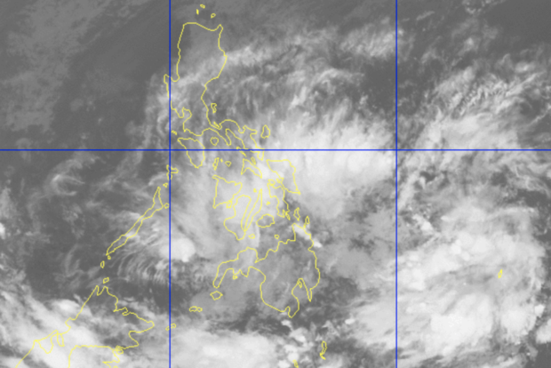

MANILA, Philippines — The trough or extension of a low-pressure area (LPA) will bring light to moderate to at times heavy rains in Western and Eastern Visayas on Saturday, according to the Philippine Atmospheric, Geophysical and Astronomical Services Administration (Pagasa).
The LPA was last spotted 660 kilometers east-southeast of General Santos City, based on the weather forecast issued by Pagasa on Friday afternoon.
Pagasa senior weather specialist Chris Perez told INQUIRER.net in a text message that the LPA is still outside the Philippine area of responsibility.
“Sa may Western at Eastern Visayas may inaasahan po tayong malawakan o malalakas na pag-ulan bukas, mga light to moderate to at times heavy rains dala pa rin ng trough ng nasabi nating LPA,” Pagasa weather specialist Ana Clauren said.
(In the Western and Eastern Visayas, we can expect widespread or heavy rains or light to moderate to at times heavy rains due to the trough of the LPA.)
Clauren warned of possible flooding or landslides in the said regions during a heavy downpour of rain caused by the weather disturbance.
She said the LPA is less likely to develop into a tropical depression, but it has a thick trough which caused widespread rains in the Visayas and several parts of Mindanao earlier in the day.
The LPA’s trough will continue to bring rains in Visayas, Caraga, Northern Mindanao, and the Zamboanga Peninsula this Friday evening, Clauren also said.
Meanwhile, the northeast monsoon will bring cloudy skies with light rains in Cordillera Administrative Region and Cagayan Valley on Saturday.
Metro Manila and the rest of Luzon will have fair weather, but isolated light rains may occur due to the northeast monsoon.
Further, Mindanao will have sunny weather, with rains possibly occurring only in the afternoon or evening. [ac]
RELATED STORY
LPA to enter PAR on Christmas morning