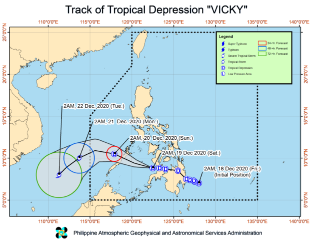
TD Vicky inches closer to Palawan ahead of expected landfall

Source: Pagasa / DOST
MANILA, Philippines — Tropical Depression Vicky continues to inch closer toward Palawan ahead of its expected landfall, the state weather bureau said Saturday.
In its 2 p.m. weather update, the Philippine Atmospheric, Geophysical and Astronomical Services Administration (Pagasa) said that Vicky was last spotted at 185 kilometers east southeast of Puerto Princesa, Palawan.
Vicky packed maximum sustained winds of 45 kilometers per hour (kph) near the center, and gustiness of up to 55 kph.
The tropical depression was also monitored moving westward at 20 kph.
State meteorologists said that Vicky is expected to make landfall in the vicinity of northern or central portion of Palawan Saturday night.
Tropical Cyclone Wind Signal No.1 is hoisted over:
- The northern and central portions of Palawan (Araceli, Dumaran, Taytay, El Nido, San Vicente, Roxas, Puerto Princesa City, Aborlan, Narra, Quezon, Sofronio Espanola) including Calamian
- Cuyo
- Cagayancillo
- Kalayaan Islands
- Vicky is expected to leave the Philippine Area of Responsibility Sunday afternoon or Sunday night, Pagasa said.