Signal No. 3 in Catanduanes as Typhoon Rolly inches closer to Bicol
MANILA, Philippines — Tropical Cyclone Wind Signal (TCWS) No. 3 was raised over Catanduanes as Typhoon Rolly (international name: Goni) inches closer to the Bicol region, the state weather bureau said in its 11 a.m. severe weather bulletin on Saturday.
Under TCWS No. 3, winds of greater than 121 kilometers per hour (kph) to 170 kph may be expected, the Philippine Atmospheric, Geophysical and Astronomical Services Administration (Pagasa) said.
Pagasa reported that Typhoon Rolly was last spotted at 480 kilometers east northeast of Virac, Catanduanes.
“Rolly” packs maximum sustained winds of 215 kph near the center, gustiness of up to 265 kph and is moving west southwest at 20 kph.
TCWS No. 2 is up over the following areas:
- The central and southern portions of Quezon (Mauban, Sampaloc, Lucban, Candelaria, Dolores, Tiaong, San Antonio, Sariaya, Tayabas City, Lucena City, Pagbilao, Atimonan, Padre Burgos, Agdangan, Unisan, Plaridel, Gumaca, Pitogo, Macalelon, General Luna, Catanauan, Mulanay, San Francisco, San Andres, San Narciso, Buenavista, Lopez, Calauag, Guinayangan, Tagkawayan, Quezon, Alabat, Perez) including Polillo Islands
- Camarines Norte
- Camarines Sur
- Albay
- Sorsogon
- Burias and Ticao Islands
- Marinduque
- Northern Samar
Meanwhile, TCWS No. 1 is up over the following areas:
- The rest of Masbate
- the rest of Quezon
- Rizal
- Laguna
- Cavite
- Batangas
- Romblon
- Occidental Mindoro including Lubang Island
- Oriental Mindoro
- Metro Manila
- Bulacan
- Pampanga
- Bataan
- Zambales
- Tarlac
- Nueva Ecija
- Aurora
- Pangasinan
- La Union
- Benguet
- Ifugao
- Nueva Vizcaya
- Quirino
- the southern portion of Isabela (Aurora, Luna, Reina Mercedes, Naguilian, Benito Soliven, San Mariano, Palanan, Dinapigue, San Guillermo, Echague, San Agustin, Jones, Cordon, Santiago City, Ramon, San Isidro, Angadanan, Alicia, Cauayan City, Cabatuan, San Mateo)
- The northern portion of Samar (Tagapul-An, Almagro, Santo Nino, Tarangnan, Catbalogan City, Calbayog City, Santa Margarita, Gandara, Pagsanghan, San Jorge, Jiabong, Motiong, Paranas, San Jose de Buan, Matuguinao)t
- he northern portion of Eastern Samar (Taft, Can-Avid, Dolores, Maslog, Jipapad, Arteche, Oras, San Policarpo)
- Biliran
Typhoon’s track
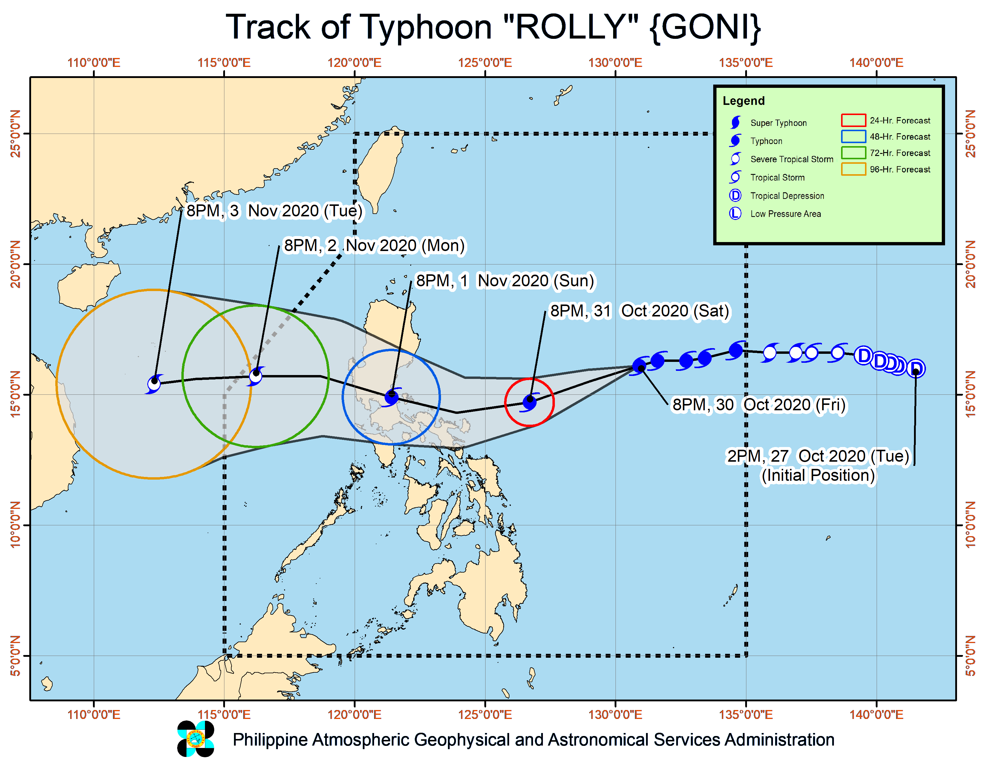
State meteorologists forecast that center of the eye of the typhoon will pass very close to Catanduanes, Calaguas Islands, and very close to mainland Camarines provinces by Sunday morning, and over Polillo Islands and mainland Quezon by Sunday afternoon.
“Rolly is likely to remain a typhoon category (185-205 kph) by the time it grazes Bicol Region and makes landfall over Quezon. During its traverse over Luzon, Rolly is forecast to weaken considerably and emerge as a severe tropical storm or minimal typhoon over the West Philippine Sea,” Pagasa said.
By early Sunday morning, “Rolly” will bring heavy to intense rains over Metro Manila, Bicol region, Calabarzon (Cavite, Laguna, Batangas, Rizal, Quezon), Central Luzon, Marinduque, and the northern portions Occidental Mindoro and Oriental Mindoro, the state weather bureau said.
Moderate to heavy rains will be experienced over Cagayan Valley, Cordillera Administrative Region, Ilocos Region, Romblon, and the rest of Occidental Mindoro and Oriental Mindoro also due to Rolly, Pagasa added.
gsg