‘Quinta’ now over Mindoro strait; Signal No. 3 up northwest of province
MANILA, Philippines — Only one area in Luzon remained under Tropical Cyclone Warning Signal No. 3 while Metro Manila is currently under Signal No. 1 as Typhoon Quinta is now over Mindoro strait while maintaining its strength on Monday, the Philippine Atmospheric, Geophysical and Astronomical Services Administration (Pagasa) said.
Pagasa said the northwestern portion of Occidental Mindoro (Abra de Ilog, Mamburao, Paluan) including Lubang Island remained under Signal No. 3.
Meanwhile, the following areas remained under Signal No. 2:
- Oriental Mindoro
- the rest of Occidental Mindoro
- Calamian Islands
- Batangas
- the extreme northern portion of Antique (Caluya)
Signal No. 1 was also placed over the following areas:
- The southern portion of Zambales (San Antonio, Castillejos, Subic, Olongapo City)
- Bataan
- the southwestern portion of Pampanga (Floridablanca, Lubao, Sasmuan, Masantol)
- the southwestern portion of Bulacan (Hagonoy, Paombong, Malolos City, Bulacan, Obando, Meycauayan City)
- Metro Manila, Rizal
- Cavite
- Laguna
- Quezon including Polillo Islands
- Marinduque
- Romblon
- the northern portion of Palawan (El Nido, Taytay) including Cuyo Islands
- Aklan
- the rest of the northern portion of Antique (Laua-An, Barbaza, Tibiao, Culasi, Sebaste, Pandan, Libertad)
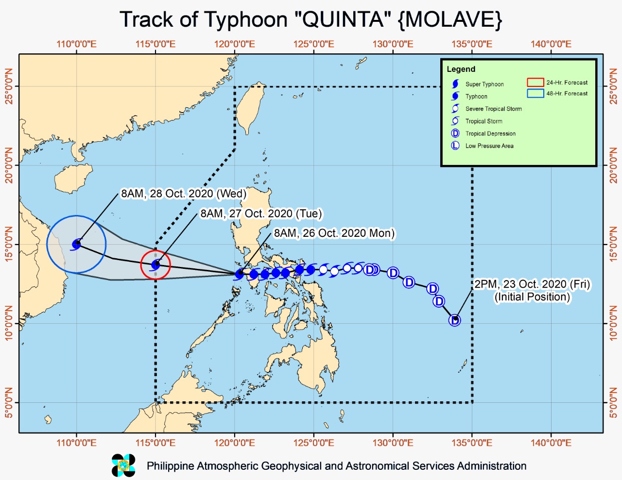
At 10 a.m., Quinta was located 125 kilometers north of Coron, Palawan, or 120 km west southwest of Calapan City, Oriental Mindoro.
It is packing maximum sustained winds of 125 km per hour and gustiness of up to 150 kph, moving westward with a speed of 25 kph.
Pagasa said Quinta will continue to move westward until Monday afternoon and will turn west-northwestward towards the western boundary of the Philippine Area of Responsibility.
The typhoon is seen to re-intensify and may reach its peak intensity within 24 to 48 hours.
It is likewise seen to exit PAR on Tuesday morning.
Moderate to intense rainfall
Pagasa said Quinta will bring moderate to heavy with at times intense rains over Occidental Mindoro, Oriental Mindoro, Romblon, Marinduque, northern Palawan including Calamian and Cuyo Islands, Calabarzon, Aurora, Isabela, Quirino, Mountain Province, Ifugao, Benguet, Aklan, Capiz, and Antique.
Due to the tail-end of a frontal system, moderate to heavy rains will be experienced over Cagayan, Apayao, Kalinga, Abra, Ilocos Norte, and Ilocos Sur.
Pagasa said the two weather systems will also bring light to moderate with at times heavy rains over Metro Manila, Western Visayas, Zamboanga Peninsula, Bangsamoro, Northern Mindanao, Caraga, and the rest of Luzon.
The weather bureau warned of possible flooding (including flash floods) and rain-induced landslides, especially during heavy or prolonged rainfall.
Destructive winds
“Destructive typhoon-force winds” is expected over areas under Signal No. 3, Pagasa said, while damaging gale to storm-force winds will be experienced over areas under Signal No. 2
Meanwhile, areas under Signal No. 1 will have strong breeze to near gale conditions.
Due to the northeasterly surge, strong breeze to gale conditions will also prevail over Ilocos Region, Batanes, Cagayan, Apayao, and northern Zambales.
Coastal waters
Pagasa said rough to high seas will be experienced over the seaboards of areas under TCWS, while rough to very rough seas will also prevail over the remaining seaboards of Luzon and the western, northern, and eastern seaboards of Visayas.
“Sea travel is risky for all types of sea vessels over these waters,” the weather bureau said.
Meanwhile, moderate to rough seas will be experienced over the other seaboards of the country.
The weather bureau is also monitoring a low pressure area, which was located at 1,920 km east of Southern Luzon at 10 a.m. on Monday.
Pagasa said the LPA may enter PAR on Wednesday or Thursday morning, but it is “less likely to develop into tropical depression in the next 48 hours.”