
Source: Pagasa / DOST
MANILA, Philippines — Areas in the extreme northern Luzon, Palawan, and Visayas may experience rainshower on Tuesday due to the effects of southwest monsoon and the frontal systems up north.
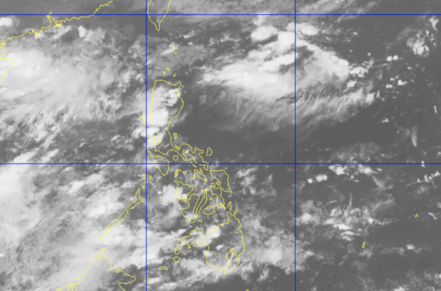
Based on the weather updates of the Philippine Atmospheric, Geophysical and Astronomical Services Administration (Pagasa) on Monday afternoon, the southwest monsoon still has an effect on western provinces in Palawan and Visayas.
Meanwhile, the tail end of the frontal system, which was generated when warm and cold air meet, would bring thunderstorms in the provinces of Batanes, Cagayan, and Ilocos Norte.
For a huge part of the country though, weather is expected to be generally fair although isolated thunderstorms may still be possible especially in the afternoon and night.
Temperatures over Metro Manila and Legazpi may hover around 25 to 33 degrees Celsius, while Puerto Princesa may feel a slightly colder weather due to the rains, with 25 to 31 degrees.
Cebu and Iloilo’s temperatures would be slightly colder due to the monsoon, ranging from 26 to 31 degrees Celsius compared to Tacloban’s 26 to 32 degrees. In Mindanao, Zamboanga is expected to register temperatures within 24 to 32 degrees, while it may be 25 to 32 degrees in Davao.
Pagasa is currently monitoring two tropical cyclones outside the Philippine area of responsibility, but neither of the two are expected to directly affect the country.
Sea condition in Luzon’s northern and western seas, plus Mindanao’s eastern waters would be moderate, while the rest of the country’s coastlines would have slight to moderate condition. This means fisherfolk and boat transfer operators using small boats can set sail.