
Source: Pagasa / DOST
MANILA, Philippines — Typhoon Kammuri slowed down while maintaining its strength, the state weather bureau said Saturday.
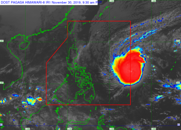
In its 11 a.m. weather update, the Philippine Atmospheric, Geophysical and Astronomical Services Administration (Pagasa) said that Kammuri was last spotted at 1,220 kilometers east of Southern Luzon.
Kammuri is packing maximum sustained winds of 150 kilometers per hour (kph) near its center, and gustiness of up to 185 kph.
The typhoon was also monitored moving west southwest at 15 kph.
Pagasa forecasted that Kammuri will enter the Philippine Area of Responsibility (PAR) on Saturday, which is also the opening day of the 30th Southeast Asian (Sea) Games.
Once it enters the PAR, it will be given the local name Tisoy, Pagasa said.
Tropical Cyclone Winds Signal No. 1 may be raised over Northern and Eastern Samar once Tisoy enters, the state weather bureau added.
Kammuri may intensify before it makes landfall, Pagasa noted. However, its intensification into a super typhoon is less likely, but is not ruled out.
The state weather bureau said that Kammuri may bring moderate to heavy rains and thunderstorms starting Monday, Dec. 2, over the Bicol Region and Samar provinces.
Meanwhile, Most of the areas in Central Luzon, Southern Luzon, and Metro Manila will experience strong winds and heavy rains Tuesday, Dec. 3, and Wednesday, Dec. 4.