Tropical Storm Sarah to weaken as it moves away from PAR
MANILA, Philippines – Severe Tropical Storm Sarah (Fung-Wong) is expected to weaken as it moves away from the Philippine area of responsibility (PAR), the latest weather update disclosed on Thursday.
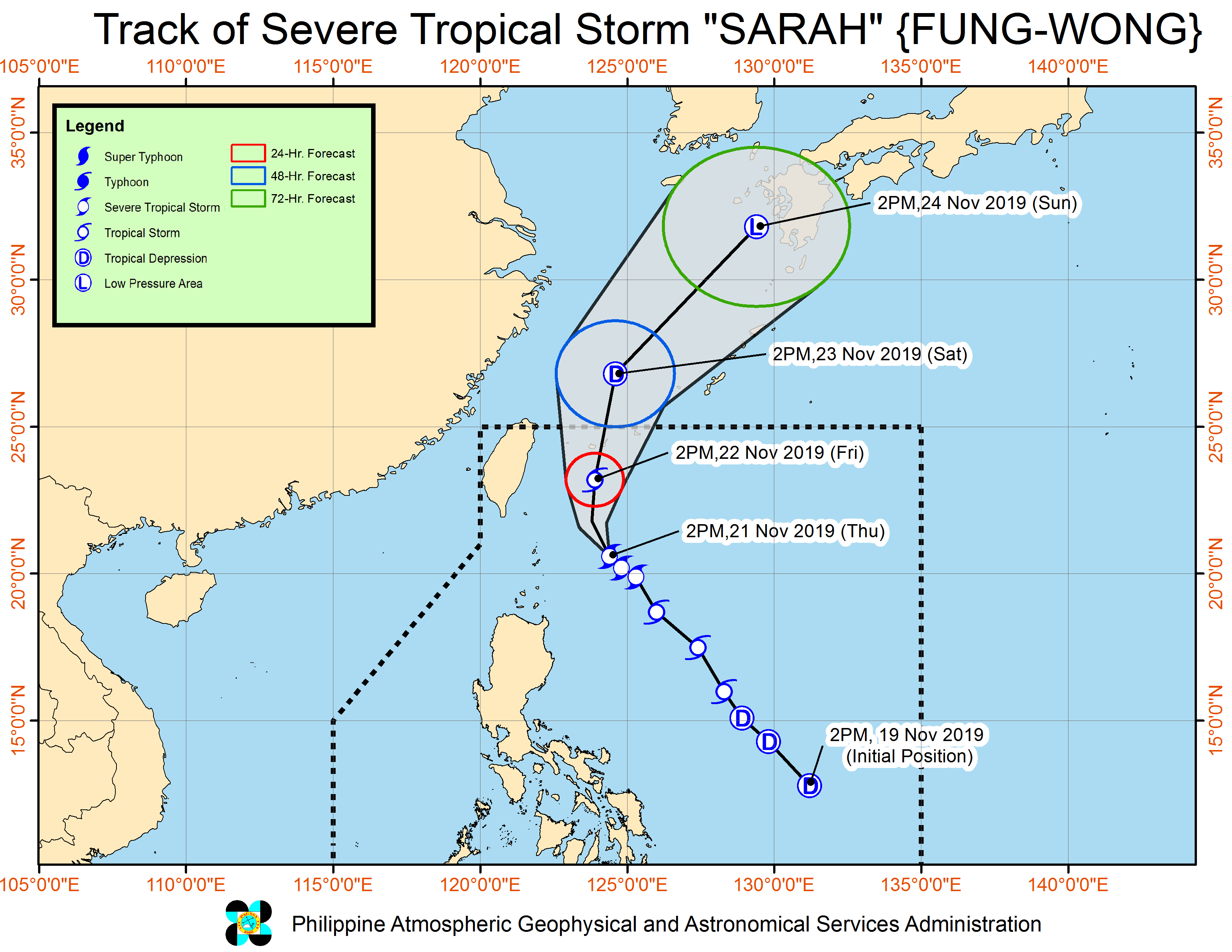
According to the 5 p.m. update of the Philippine Atmospheric, Geophysical, Astronomical Services Administration (Pagasa), the expected weakening of Sarah is due to its northward movement, meaning it would encounter cold air brought by the northeast monsoon or Amihan.
Sarah was last seen 255 kilometers east of Basco, Batanes, and is now packing maximum sustained winds of 110 kilometers per hour (kph) and gustiness of up to 135 kph. It is moving northwest at a speed of 10 kph.
“From severe tropical storm nakikita natin na bahagyang hihina na ito na isang tropical storm na lamang dahil papasok na siya doon sa malamig na sektor kung saan meron nga tayong Amihan,” Pagasa weather specialist Benison Estareja said.
(From severe tropical storm we see that it would slightly weaken to a tropical storm because it would enter the cold sectors where the northeasterly winds are prevalent.)
Article continues after this advertisement“Bukod ‘don sa Batanes, matataas din po ang alon sa parteng Ilocos Norte, Ilocos Sur, La Union, Pangasinan, gayun din sa buong Cagayan, Isabela, at maging dito sa Zambales at western coast of Palawan. Dahil po ‘yan sa pinagsamang epekto ng Amihan at ni Bagyong Sarah,” he added.
Article continues after this advertisement(Aside from Batanes, high waves should also be expected in Ilocos Norte, Ilocos Sur, La Union, Pangasinan, the whole of Cagayan, Isabela, and even in Zambales and the western coast of Palawan. That is because of the combined effects of the northeastern monsoon and Sarah.)
Tropical Cyclone Wind Signal No. 1 is still raised over Batanes though, while gale warnings were issued in the northern and western seaboards of Luzon, as well as the western coastlines of Palawan province as they may experience waves as high as 4.5 meters.
As of now, Sarah is not expected to make landfall although its tailwinds may still affect the northern and eastern part of Luzon. Light to moderate rains with isolated heavy rain showers are expected over Isabela, Cagayan, and northern Aurora.
“Base po sa kinikilos nito ngayon ay hindi na ito tatama sa kalupaan anywhere in Luzon, pero asahan po natin ‘yong trough nitong si Sarah nakaka-apekto pa rin dito sa Batanes, as well as Cagayan and Isabela provinces,” he explained.
(Based on its movement, it would not make landfall anywhere in Luzon, but we expect the trough of Sarah to affect Batanes, as well as Cagayan and Isabela provinces.)
Meanwhile, the low-pressure area (LPA) which used to be Tropical Depression Ramon was last seen at the West Philippine Sea, at 375 kilometers east of Subic, Zambales, and will exit PAR on Friday.
Zambales and Bataan provinces may still experience occasional rain showers due to the trough of the LPA.