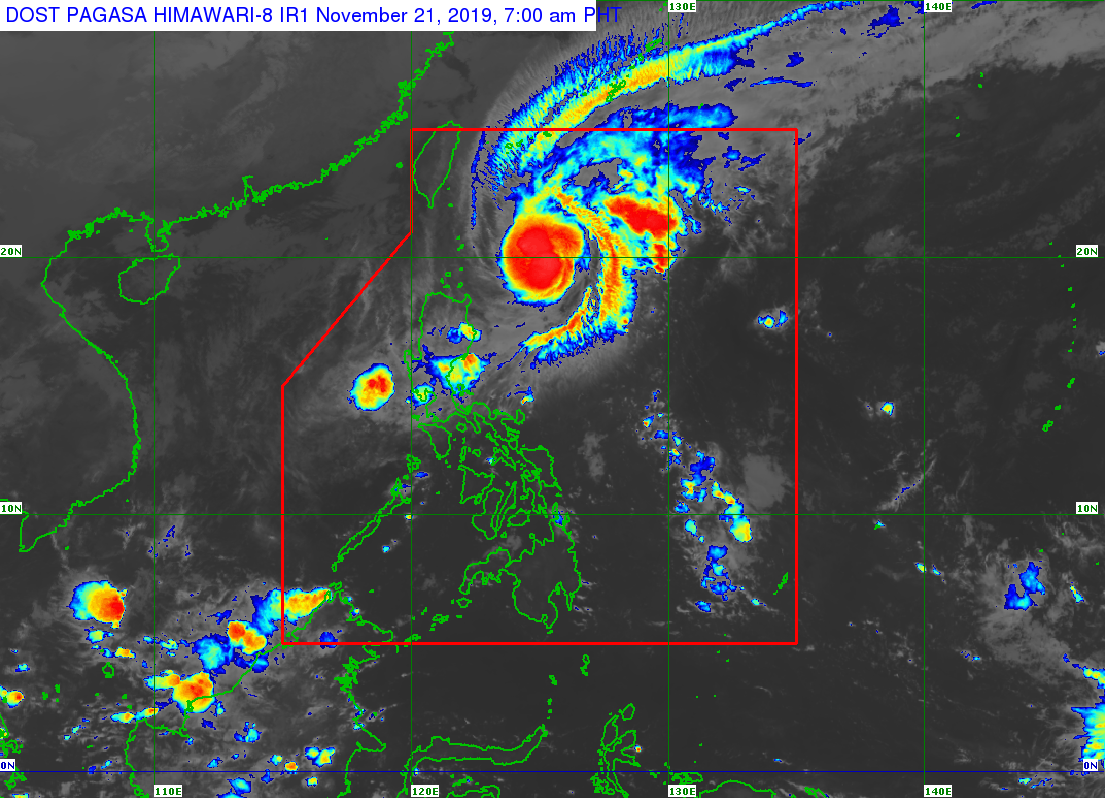
Sarah intensifies to severe tropical storm
MANILA, Philippines — Tropical Storm Sarah intensified into a severe tropical storm, the state weather bureau said Thursday.
In its 4 a.m. weather bulletin, the Philippine Atmospheric Geophysical and Astronomical Services Administration (Pagasa) said Sarah was last spotted at 425 kilometers east-northeast of Aparri, Cagayan or 340 kilometers east of Basco, Batanes.
Sarah also packed maximum sustained winds of 95 kilometers per hour (kph) near the center, and gustiness of up to 115 kph.
The severe tropical storm was also monitored moving north-northwest at 25 kph.
Pagasa said that due to changes in the forecast track of Sarah, it has lifted Tropical Cyclone Wind Signal (TCWS) No. 1 which was earlier hoisted over mainland Cagayan.
Article continues after this advertisementShould such changes continue, TCWS No.1 hoisted over Batanes and Babuyan Islands may also be lifted, Pagasa added.
Meanwhile, the low-pressure area (LPA) that was previously Tropical Depression Ramon was spotted at 110 kilometers west of Subic, Zambales.
Both Sarah and the LPA will bring light to moderate with isolated heavy rain showers over Isabela, Cagayan (especially on the eastern section), Aurora, northern Quezon, Metro Manila and most of Central Luzon, the state weather bureau said.
