
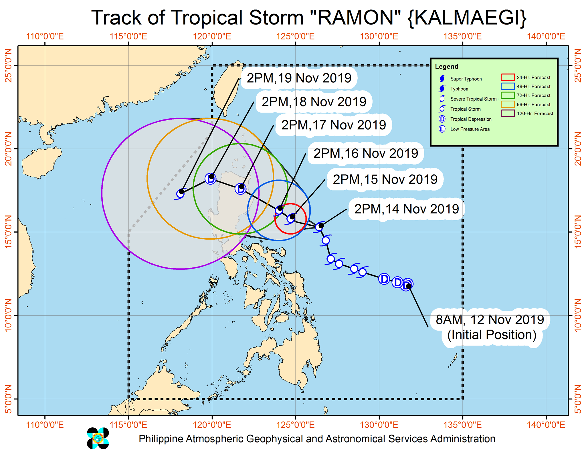
MANILA, Philippines—Tropical Storm Ramon, which has maintained its strength as it moves closer to the Luzon region, is expected to make landfall over northern Isabela or Cagayan province by Sunday, the Philippine Atmospheric, Geophysical and Astronomical Services Administration (Pagasa) said.
In its 5 p.m. weather bulletin, the weather state bureau said Ramon was last seen 500 km East of Baler, Aurora with maximum sustained winds up to 65 kph near the center and gustiness of up to 80 kph.
Ramon is moving in a north-northwest direction at 15 kph, Pagasa said.
Tropical Cyclone Wind Signal Number 2 is still raised over Catanduanes while Signal No. 1 is raised over the Eastern portion of Isabela (Divilacan, Palanan, Dinapigue), Northern Aurora (Dilasag, Casiguran, Dinalungan), Polillo Island, Camarines Norte, Camarines Sur, and Albay.
On Friday, light to moderate with occasional heavy rain showers may be experienced over the eastern portion of Cagayan and Isabela. Light to moderate with intermittent heavy rain showers over northern Aurora, Camarines Norte, and Polillo Island.
Residents in the aforementioned areas, especially those living in areas identified to be highly or very highly susceptible to flooding and rain-induced landslides, are advised to take precautionary measures, coordinate with local disaster risk reduction and management offices, and continue monitoring for updates.
Pagasa warned that sea travel is risky, especially for small sea crafts, over the seaboards of areas under Tropical Cyclone Wind Signal, the seaboards of northern Luzon, and the eastern seaboards of Aurora and Quezon due to prevailing or forecast rough sea conditions.