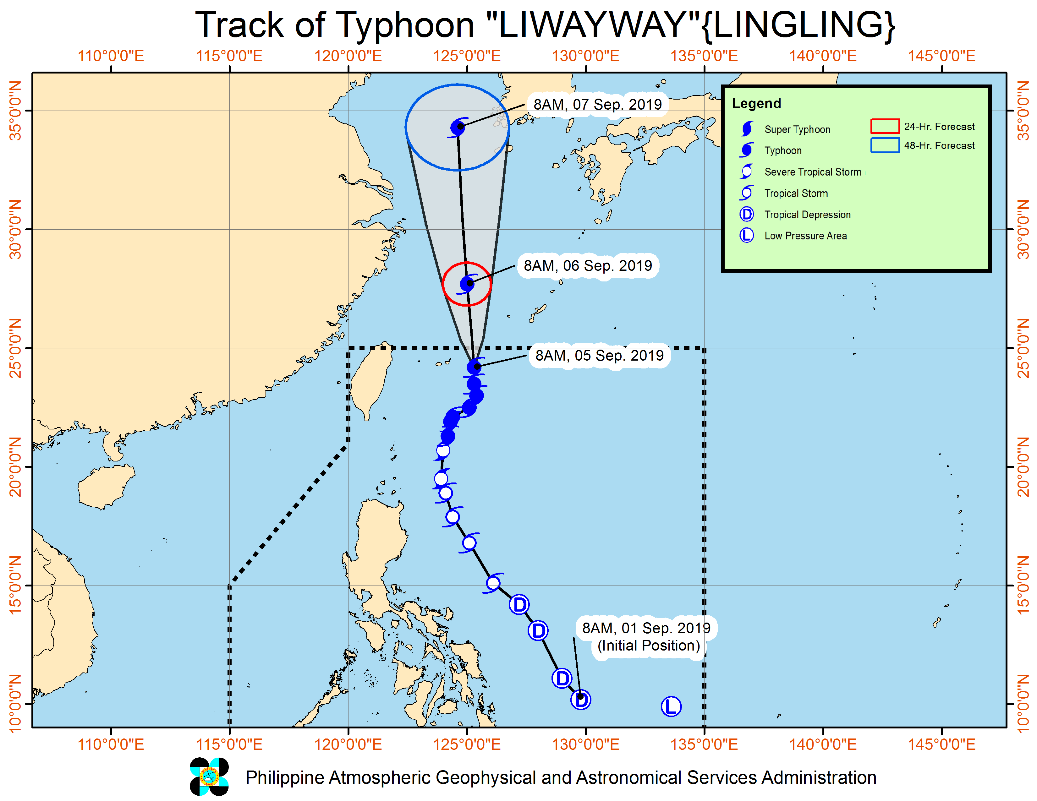
‘Liwayway’ intensifies further as it nears PAR exit

PHOTO FROM DOST PAGASA
MANILA, Philippines — Typhoon “Liwayway” intensified further on Thursday morning as it continued its way out of the Philippine Area of Responsibility (PAR), the state weather bureau reported.
As of 10 a.m., the Philippine Atmospheric, Geophysical and Astronomical Services Administration (Pagasa) said Liwayway was spotted 555 kilometers northeast of Basco town in Batanes.
The storm intensified with maximum sustained winds of 165 kilometers per hour (kph) near the center and gustiness of up to 205 kph.
Liwayway continues to move north at a speed of 15 kph and is expected to exit PAR on Thursday afternoon or evening.
Pagasa said light to moderate with intermittent heavy rains will be experienced over Batanes and Babuyan Islands.
Meanwhile, the southwest monsoon will bring scattered light to moderate rains, with at times isolated heavy rain showers during thunderstorms, over Ilocos Region and Cordillera Administrative Region.
The state weather bureau is also monitoring a low pressure area (LPA) spotted 860 kilometers east northeast of Hinatuan, Surigao del Sur as of 10 a.m.
The LPA is less likely to develop into a tropical depression within the next 48 hours, Pagasa reported. /je


