Pagasa: LPA unlikely to intensify into tropical depression
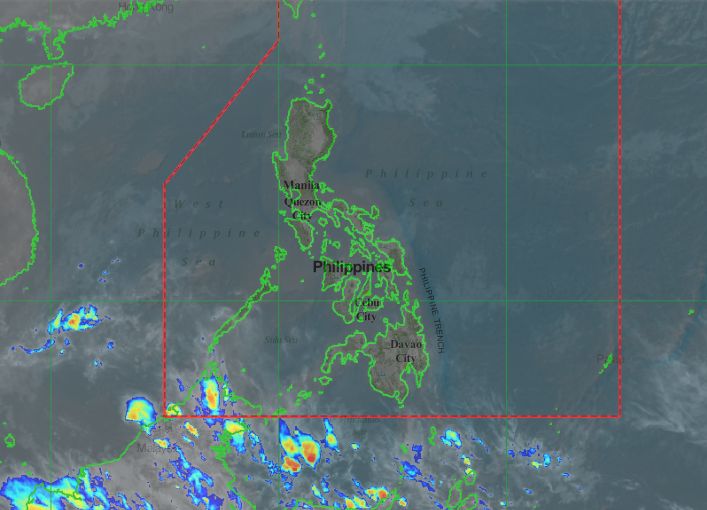
MANILA, Philippines — The low-pressure area (LPA) tracked by the state weather bureau is continuing to grow closer to the Philippine Area of Responsibility (PAR) but is unlikely to intensify into a tropical depression in the next 24 hours.
In its afternoon update, the Philippine Atmospheric, Geophysical and Astronomical Services Administration (Pagasa) said the LPA was last spotted 2,840 kilometers (km) east southeast of Mindanao.
However, Pagasa weather specialist Ariel Rojas reminded that while the LPA remains outside the PAR, it is accumulating strength as it intensifies into a tropical depression.
The LPA is expected to enter the PAR on Friday (January 18) or Saturday (January 19). It will be given a local name of “Amang.”
“Ito’y nasa kalagitnaan pa ng karagatan kaya may oras pa itong mag-accumulate ng moisture na siyang magfu-fuel sa kanyang pag-intensify or pag-develop bilang isang tropical depression,” Rojas said.
Article continues after this advertisementMeanwhile, the northeast monsoon or “Amihan” is currently affecting Luzon and Visayas.
Article continues after this advertisementLight rains are expected over different parts of northern Luzon.
Due to the northeast monsoon, cloudy skies and light rains will prevail over the Cagayan Valley region while partly cloudy skies or generally fair weather is expected over the rest of Luzon, including Metro Manila.
Partly cloudy to cloudy skies or generally fair weather with chances of isolated light rains may prevail over Palawan and the rest of Visayas due to the northeast monsoon.
Generally fair weather can also be expected over Mindanao with the possibility of cloudy skies and rains due to localized thunderstorms.
So far, no gale warnings were raised by Pagasa. However, fisher folks were still advised to exercise caution if they plan to venture over the northern and eastern seaboards of the country due to moderate to rough seas.
