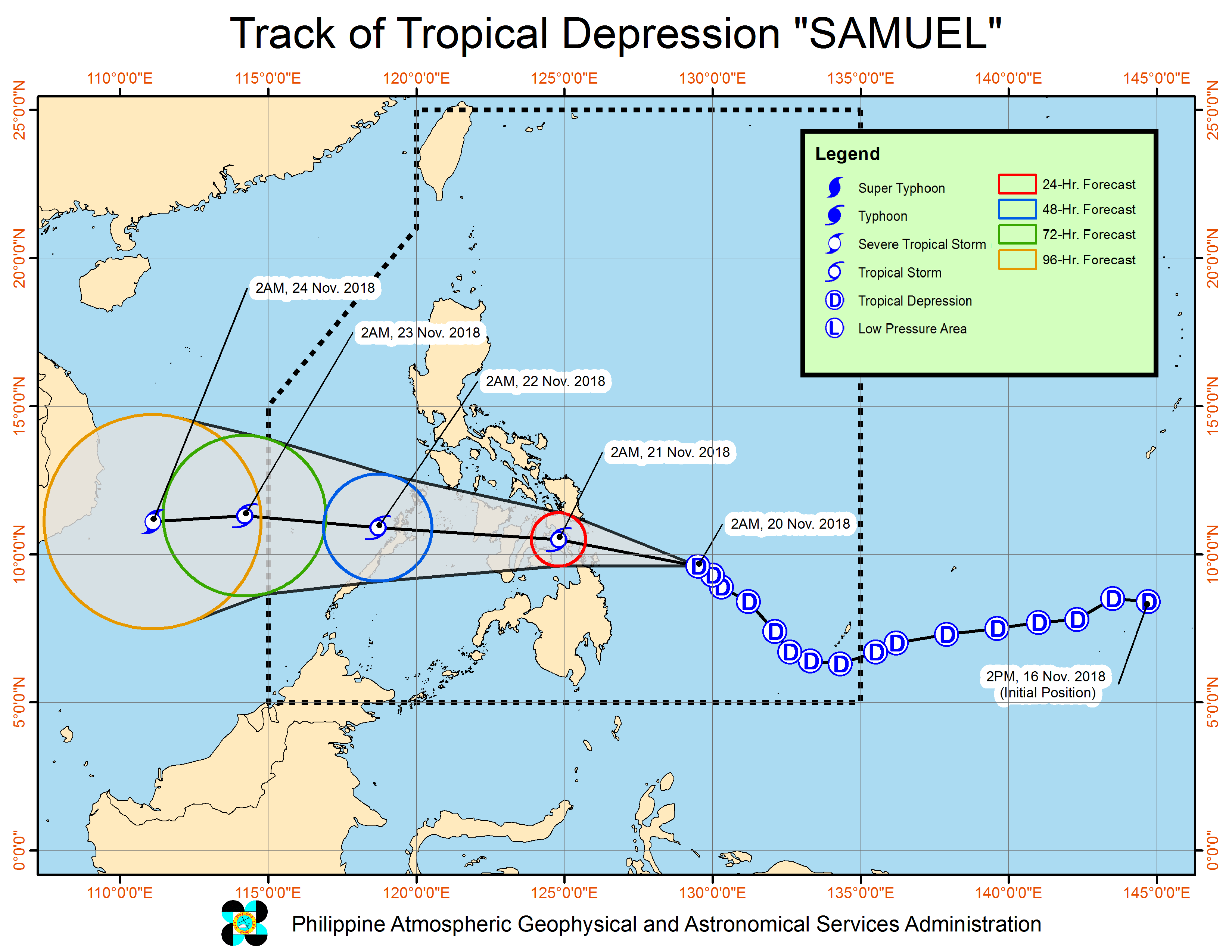
Samuel inches closer to Eastern Visayas
Tropical Depression Samuel has maintained its strength as it moves closer to make a landfall in the areas of Dinagat-Samar-Leyte, the state weather bureau said on Tuesday.
According to the Philippine Atmospheric, Geophysical and Astronomical Services Administration (Pagasa), Samuel was last spotted 395 kilometers east of Surigao City, Surigao del Norte as of 4 a.m.
It has a maximum sustained winds of 55 kilometers per hour (kph) and gustiness of up to 65 kph.
Samuel will affect the regions the Caraga, Northern Mindanao, Eastern Visayas, Central and Western Visayas, and Bicol Regions.
Pagasa warned the residents in the affected areas of possible flashfloods and landslides.
Article continues after this advertisementThe state weather bureau also hoisted typhoon Signal Number 1 in 28 areas in the country.
Article continues after this advertisementIn Luzon, the following provinces have been placed under the said typhoon signal: Masbate incl. Ticao Island, Romblon, southern Oriental Mindoro, southern Occidental Mindoro, and Northern Palawan incl. Cuyo Island and Calamian Group of Islands
In Visayas, the Northern Samar, Eastern Samar, Samar, Biliran, Leyte, Southern Leyte, Bohol, Cebu, Siquijor, Negros Oriental, Negros Occidental, Guimaras, Iloilo, Capiz, Aklan, and Antique were placed under the typhoon watch.
Lastly, the provinces in Mindanao particularly Dinagat Islands, Surigao del Norte, Surigao del Sur, Agusan del Norte, Agusan del Sur, Misamis Oriental, and Camiguin, were placed under signal number 1.
Pagasa also raised a gale warning over the eastern seaboards of southern Luzon due to Samuel.
The agency said that the sea condition in Catanduanes, eastern coast of Albay, and eastern coast of Sorsogon would be rough to be very rough with a wave height of 2.6 to 4.5 meters.
It advised fishing boats and other small seacrafts to avoid sea travel, while larger sea vessels were alerted against big waves.
