Pagasa warns: ‘Rosita’ packs ‘Ompong’-like punch
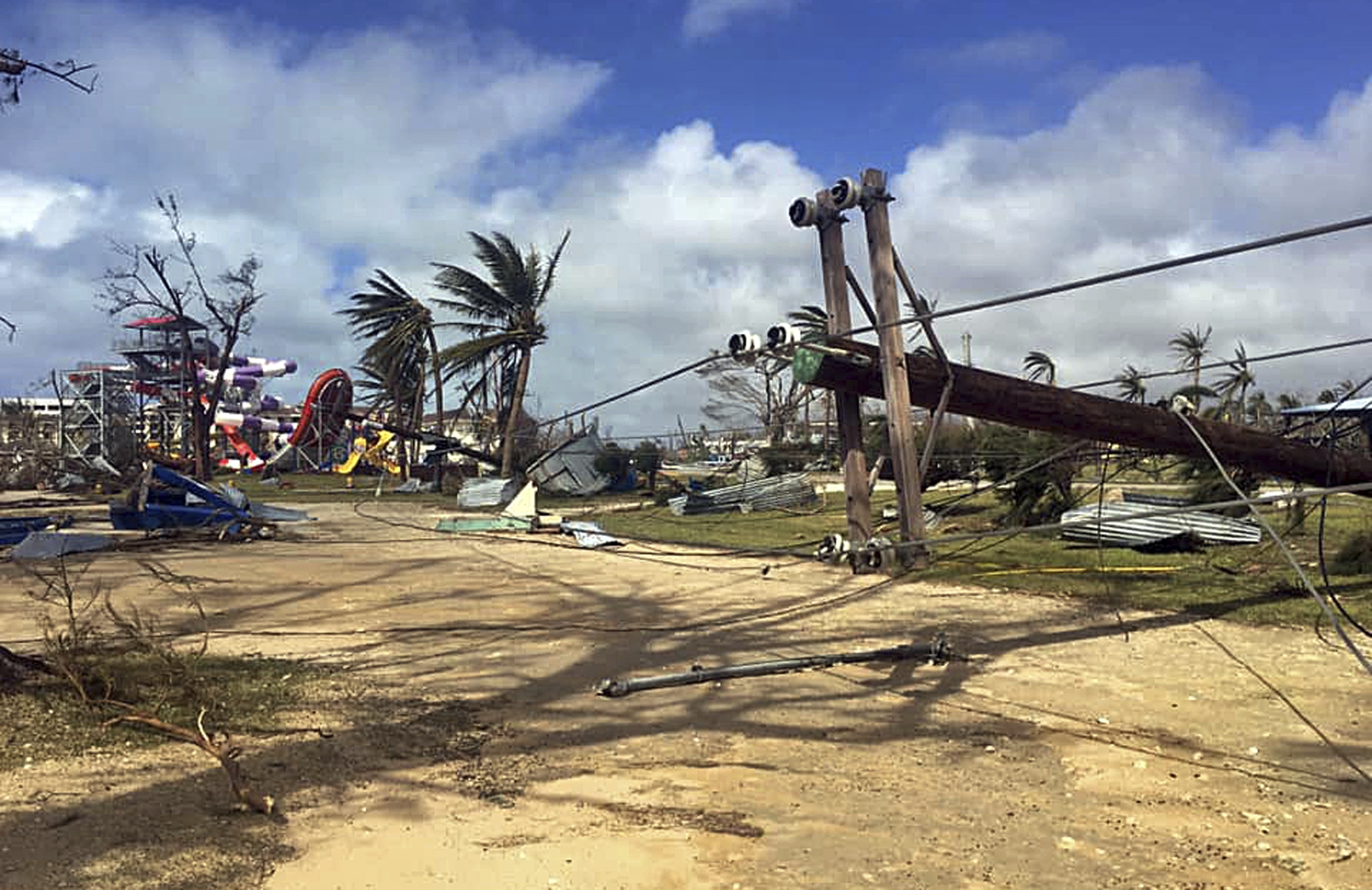
HINT OF THINGS TO COME? Supertyphoon “Yutu,” later to be renamed Typhoon “Rosita” after entering the Philippine area of responsibility, smashed cars, toppled utility poles and communication towers, and destroyed houses and buildings after sweeping through the US territory of the Commonwealth of the Northern Mariana Islands last Thursday. —AP
Less than four days after ravaging the US territory of Northern Marianas, Typhoon “Rosita” (international name: Yutu) threatens to cut a deadly path across northern Luzon as the powerful storm gathers strength ahead of its expected landfall on Tuesday.
Weathermen warned on Saturday that Rosita could approximate the ferocity of Typhoon “Ompong” (international name: Mangkhut), which devastated the northern parts of the country in mid-September with sustained Category 4 winds of more than 220 kilometers per hour.
Classes in schools in Cagayan and Isabela, the two provinces directly in the path of Rosita, are expected to be called off by the regional offices of the education department as early as Monday, when rains are forecast to saturate eastern and northern Luzon.
At a press briefing at noon on Saturday, the Philippine Atmospheric, Geophysical and Astronomical Services Administration (Pagasa) said Metro Manila may be placed under Storm Signal No. 1 on Monday night.
As of 4 p.m. on Saturday, Pagasa said the eye of the storm was located 1,214 km east of Aparri, Cagayan, well inside the Philippine area of responsibility, moving westward at a speed of 25 kph.
Article continues after this advertisementRosita is expected to bring heavy rains and strong winds over northern and central Luzon on Monday and Tuesday, although storm signals may be hoisted as early as Sunday night over the eastern section of central and northern Luzon, the weather bureau said.
Article continues after this advertisementForecasters estimated storm surges of up to 5 meters in the northeastern areas facing the Pacific Ocean in the next four to five days that could force the suspension of sea travel in the country’s eastern seaboards as far south as Samar Island.
Pagasa hoisted gale warnings over the same areas, expecting rough seas starting early on Sunday morning.
“Fishing boats and other small seacraft are advised not to venture out into the sea while larger sea vessels are alerted against big waves,” the bureau said.
When last tracked by weathermen on Saturday afternoon, Rosita packed maximum sustained winds of 200 kph near the center and gusts of up to 245 kph.
Pagasa said the storm’s strength and track almost matched those of Ompong, the Category 4 howler that triggered fatal landslides in the Cordilleras.
“[Rosita] is almost as strong as Ompong. When it hits land, it would be a destructive typhoon,” warned assistant weather services chief Renito Paciente. “It can possibly cause floods [in low-lying areas] and landslides, especially in mountainous areas.”
Paciente said Rosita had a 400-km radius and would bring light to heavy rains to all areas of Luzon.
The worst rainfall is expected on Tuesday, when the storm could dump up to 200 millimeters of rain in one day, said weather division chief Esperanza Cayanan.
She reminded people living near mountainous and hilly areas that the threshold for landslides was 100 mm of rainfall a day.
As at the height of Ompong’s onslaught, the San Roque and Magat dams may release water anew and cause flooding in low-lying areas, Pagasa warned.
Because Rosita is expected to cross land quicker than Ompong, according to the bureau, rains may already ease by All Saints’ Day on Nov. 1, except in western Luzon.
“Expect the winds and rain by Monday night. Plan travels in northern Luzon accordingly so you don’t get stranded or get caught in the storm,” Cayanan said, addressing the public.
“Agricultural damage is also expected, so if you can harvest crops by Sunday, that would be better. Also fortify your houses now,” she added.
The typhoon weakened a bit on Saturday after ravaging Taipan and Tinian on Thursday with maximum sustained winds of 290 kph.
The Category 5 storm, the strongest to hit US territories in the Pacific this year overturned cars, crushed small planes, destroyed houses, toppled power poles and caused landslides, according to the US Federal Emergency Management Agency. —With reports from AP and Faye Orellana