
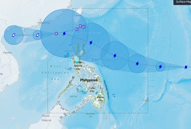
An illustration released by Pagasa shows the tracks of Typhoon ‘Neneng’ (top left) and Typhoon ‘Mangkhut’ (right). PAGASA IMAGE
Tropical Depression “Neneng” left the Philippine area of responsibility early Tuesday but its trough continued to bring rain to parts of the North.
Light to moderate rain is forecast over the Ilocos Provinces, the Cordillera Administrative Region and Cagayan Valley, the Philippine Atmospheric, Geophysical and Astronomical Services Administration (Pagasa) said.
Neneng was spotted 295 kilometers west of Basco, Batanes. It was packing maximum sustained winds of 60 kilometers per hour and gusts of up to 75 kph. It was moving west southwest at 20 kph.
Meanwhile, Typhoon “Mangkhut,” which will be locally named “Ompong” when it enters PAR on Wednesday afternoon, continues to move closer to the country.
It was spotted 1,820 kilometers east of Southern Luzon with maximum sustained winds of up to 160 kph and gusts of up to 195 kph. It was moving westward at 30 kph. /cbb