Pagasa: More rains in Luzon before weather improves Monday
Luzon will have improved weather by Monday, July 31, as Tropical Storm Huaning, internationally known as Haitang, is not expected to make landfall anywhere in the Philippines.
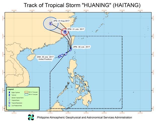
That’s the forecast issued at 5 p.m. on Sunday by Aldczar Aurelio of the Philippine Atmospheric, Geophysical and Astronomical Services Administration (Pagasa).
Meanwhile, Signal No. 1 remained hoisted over Batanes, Ilocos Norte, Northwestern Cagayan, and the Babuyan Group of Islands.
The southwest monsoon, or habagat, will continue to be enhanced by Huaning, bringing moderate to occasionally heavy rains in Northern and Central Luzon.
The rest of the country will have fair weather.
Pagasa advised residents in those areas to be alert for possible flash floods and landslides.
Earlier in the day, before dawn, Typhoon Gorio, internationally known as Nesat, exited the Philippine area of responsibility (PAR) and made landfall in China.
Shortly after, Huaning crossed into the PAR northwest of Northern Luzon. But it was not expected to stay long as it was forecast to exit PAR by the morning of Monday.
As of 4 p.m., the center of Huaning was located at 215 km northwest of Basco, Batanes, moving north at 24 kph. It had maximum sustained winds of 80 kphn near the center, with a gustiness reaching up to 110 kph. /atm