Typhoon Lando slightly gains strength, nears landfall in Aurora
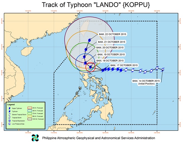
Typhoon Lando slightly gained strength and slowed down further midday Saturday as it approaches Aurora.
Esperanza Cayanan of the Philippine Atmospheric Geophysical and Astronomical Services Administration, said in press briefing that the typhoon will slam into Aurora early Sunday.
“It will weaken once it makes landfall but still at the same intensity,” she said.
The interaction with Typhoon Champi in the West Pacific has been slowing down Lando. Although Champi won’t enter the Philippine area of responsibility, Lando, being semi-stationary, will dump more rains.
READ: Typhoon Lando slows down, keeps strength | Aquino calls for calm as Lando threatens Luzon
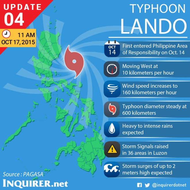
Article continues after this advertisementHeavy to intense rains are seen within the 600 kilometer radius of Lando.
Article continues after this advertisementFishermen were warned to avoid the seaboards of Luzon, Visayas and the eastern seaboard of Mindanao.
Storm surges may reach a maximum of two meters in Aurora and nearby provinces. Wave height in open sea may reach up to 14 meters or higher, Cayanan warned.
As of 10 a.m. Lando was tracked 295 kilometers east of Baler, Aurora. It packed maximum sustained winds of 160 kilometers per hour near the center and gusts of up to 195 kph.
Lando crawled at 10 kph westward.
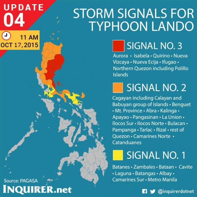
Public storm Signal No. 3 was raised in Aurora, Isabela, Quirino, Nueva Vizcaya, Nueva Ecija, Ifugao and Northern Quezon including Polillo Islands.
Cagayan including Calayan and Babuyan group of Islands, Benguet, Mt. Province, Abra, Kalinga, Apayao, Pangasinan, La Union, Ilocos Sur, Ilocos Norte, Bulacan, Pampanga, Tarlac, Rizal, rest of Quezon, Camarines Norte and Catanduanes were placed under Signal No. 2.
Areas placed under Signal No. 1 were Batanes, Zambales, Bataan, Cavite, Laguna, Batangas, Albay, Camarines Sur and Metro Manila.
Occasional rains and gusty winds will be experienced over areas under Signal No. 1 while those under Signals No. 2 and 3 will have stormy weather.
National Disaster Risk Reduction and Management Council Executive Director Alexander Pama reiterated his call to travelers to postpone their trips to the north this weekend. CDG


