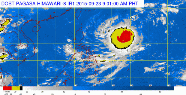
Tropical storm ‘Dujuan’ expected to enter PAR Wednesday night
Tropical storm “Dujuan” approached closer to the Philippine area of responsibility on Wednesday morning.
The storm was last located 1,745 kilometers east of Northern Luzon, the Philippine Atmospheric, Geophysical and Astronomical Services Administration (Pagasa) said.
Dujuan, which will be locally named “Jenny,” is expected to enter PAR by Wednesday evening or early Thursday.
It packed maximum sustained winds of 65 kilometers per hour near the center with gusts of 80 kph. It moved west northwest 15 kph.
READ: Bagyong papalapit ng bansa, lalo pang lumakas
Article continues after this advertisementForecasters earlier said that the storm is not likely to directly affect the country and will recurve toward Japan.
Article continues after this advertisementREAD: Tropical depression may spare PH — Pagasa
Meanwhile, the southwest monsoon (habagat) is affecting Visayas and Mindanao, Pagasa said.
Cloudy skies with light to moderate rains and isolated thunderstorms will be experienced over Mimaropa, Visayas, Mindanao and the provinces of Cavite and Batangas.
Partly cloudy to cloudy skies with isolated thunderstorms will prevail over Metro Manila and the rest of Luzon. Frances Mangosing/IDL
