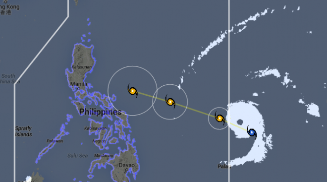
‘Maysak’ slightly weakens, heads for Isabela-Aurora
TYPHOON Maysak (local name Chedeng) slightly weakened on Wednesday afternoon but still poses a threat to the country.
The typhoon packed maximum sustained winds of 190 kilometers per hour and gusts of up to 225 kph, the Philippine Atmospheric Geophysical and Astronomical Services Administration said.
Maysak also increased its speed at 20 kph while moving west-northwest.
The typhoon is expected to enter the Philippine area of responsibility by Wednesday evening or early Thursday. It is seen to make landfall on Saturday or Sunday over Aurora, Quezon or Isabela.
Despite the typhoon, the dry or summer season officially arrived on Wednesday, Pagasa said.
Article continues after this advertisementThe ridge of a high-pressure area is affecting northern Luzon, Pagasa added.
Article continues after this advertisementCagayan Valley, Cordillera and Ilocos region will experience partly cloudy skies. Metro Manila and the rest of the country will be partly cloudy to cloudy skies with isolated rains or thunderstorms.
The effects of Maysak won’t be felt until Friday, Pagasa said.
In Metro Manila, rains and gusty winds are expected over the weekend.
The rest of the country will have warm and humid condition.
