3rd LPA forms outside PAR, may develop in 24 hours – Pagasa
LIVE UPDATES: Southwest monsoon weather continues after Crising leaves
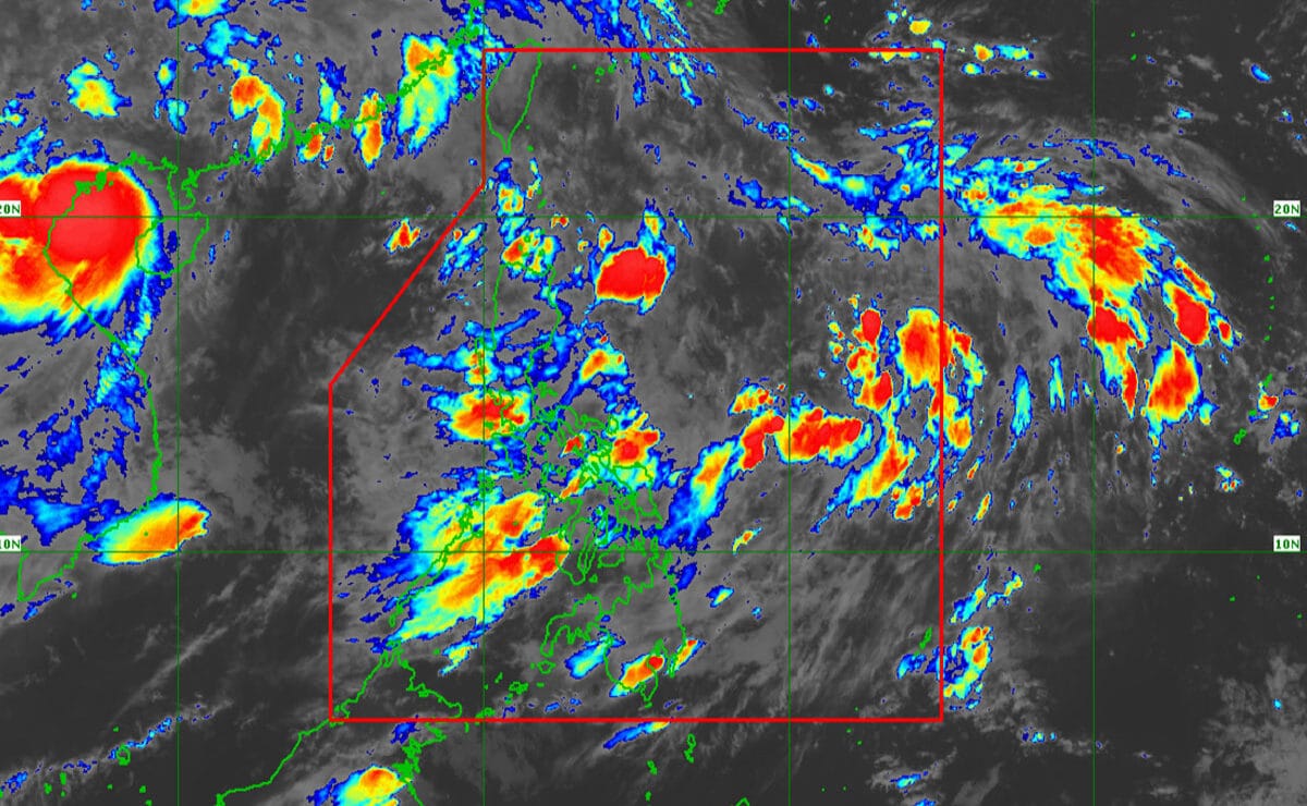
Image from DOST / Pagasa
MANILA, Philippines — In addition to the two low-pressure areas (LPAs) being monitored inside the Philippine Area of Responsibility (PAR), a third LPA was spotted outside PAR on Tuesday morning, the weather bureau said.
According to the Philippine Atmospheric, Geophysical and Astronomical Services Administration (Pagasa), the new LPA outside the PAR was last seen 2,850 kilometers east of Eastern Visayas.
It has a “medium” probability of becoming a tropical depression within the next 24 hours, Pagasa said.
2 LPAs inside PAR intensifying
Meanwhile, the two LPAs being monitored inside the PAR still have a “high” and “medium” chance of developing into tropical depressions within the next 24 hours.
The LPA east of Central Luzon, which has a strong chance of becoming a tropical depression, was last spotted 1,140 kilometers away. The second one, last located 225 kilometers east-southeast of Basco, Batanes, has a medium chance of developing within the next 24 hours.
READ: PETA urges public: Don’t leave pets behind amid rains, floods
Pagasa earlier reported that the LPA over Basco, along with the southwest monsoon or habagat, is bringing rain to various parts of the country.
READ: Red rainfall warning raised in Metro Manila, 2 Luzon provinces Tuesday
A red rainfall warning, with more than 30 millimeters of rain expected within the next three hours, was raised over Metro Manila, Bataan, and parts of Cavite as of this writing. /jpv/abc